
Διαβάστε το άρθρο στα ελληνικά.
The coastal zone (αιγιαλός): buying near the sea in Greece
On this page
The three shore lines with the paragraph behind each: what αιγιαλός, παραλία and παλαιός αιγιαλός actually are, the 100 m rule that voids a permit issued without a delimitation, who the famous 50 m setback really binds, and how to find out whether your stretch has a line at all.
This guide is a preliminary screen for a purchase or permit question, not legal, surveying, engineering or tax advice; read the full scope and limits before relying on it.
Have a specific plot in mind? Every check in this guide can be run on it, with source and date, for EUR 29 total · VAT included. Pin it on the map →
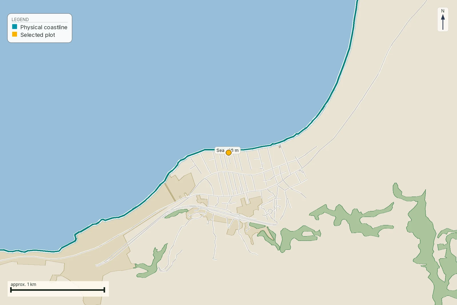
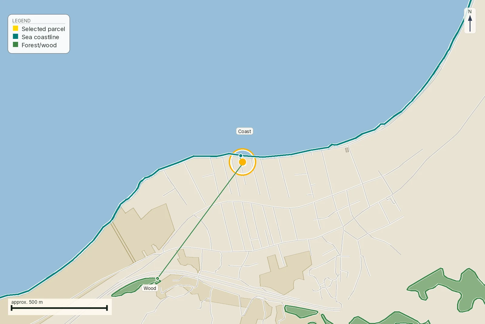
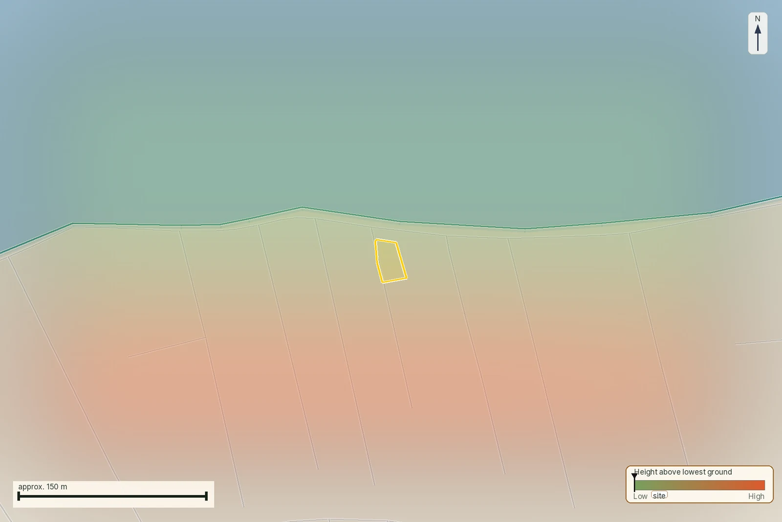
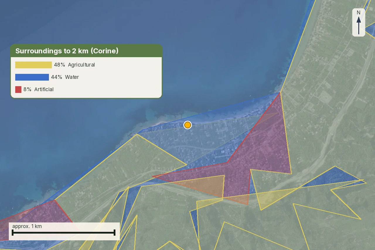
Νάξος ΕΚ10017 is 15,559 m² of flat ground at 0.3 m above sea level, and our own coastline layer puts the water three metres from it. Ask the national planning service where the αιγιαλός runs across it and the answer is silence: no line of any kind within five kilometres. That silence is what the public map layers return for most of the Greek coast. It is not a finding that nothing has ever been drawn there, and reading it as one is how coastal plots come to be mispriced in both directions.
The coast is one of the constraints in the stack covered by our guide to περιορισμοί δόμησης, and it behaves unlike the others. A forest map is posted, ratified and searchable by ΚΑΕΚ. The shore is fixed one bay at a time, by a committee, on application, and over most of the country it has never been fixed at all.
Three lines, four strips of ground
The vocabulary was rewritten in 2024. Άρθρο 3 ν. 5092/2024 (ΦΕΚ Α΄ 33/4.3.2024) now supplies the definitions for its own text and for what survives of ν. 2971/2001.
- Αιγιαλός is «η ζώνη ξηράς που βρέχεται από τη θάλασσα κατά τις μεγαλύτερες και συνήθεις αναβάσεις των κυμάτων της». The largest ordinary waves, not the largest waves ever recorded, and not the calm-summer waterline a buyer sees in July.
- Παραλία is the strip added behind it «η οποία δεν μπορεί να εκτείνεται περισσότερο από πενήντα (50) μέτρα από την οριογραμμή του αιγιαλού». It exists to protect the coast from erosion and to serve access between land and sea. It is drawn only where the committee judges it necessary.
- Παλαιός αιγιαλός is the ground the sea has left behind, «η ζώνη ξηράς, η οποία προκύπτει από τη μετατόπιση της ακτογραμμής προς τη θάλασσα». It is dry, it grows scrub, it looks exactly like the land beside it, and it is the trap this article exists for.
Three drawn lines, four strips of ground, and the fourth strip is what you are buying. None of the three is a setback measured from the water. Each is fixed by an administrative act, so until a committee has drawn it and a ΦΕΚ has published it, the position of the αιγιαλός over your plot is not settled. The engineer signing the permit study does have to mark it, under άρθρο 8 παρ. 2 ν. 2971/2001, but that marking is his own determination on a drawing rather than a ratified line, and it binds nobody else. Where your buildable ground then begins is a second question, answered by the planning rules for the plot, and this article does not answer it.
Who owns each of them
Άρθρο 6 παρ. 1 ν. 5092/2024 puts the αιγιαλός and the παραλία in the δημόσια κτήση as κοινόχρηστα πράγματα, protected and managed by the Κτηματική Υπηρεσία. Where a stretch has been designated a τουριστικό δημόσιο κτήμα, the same paragraph hands administration to ΕΤ.Α.Δ. Α.Ε. instead. Παρ. 3 forbids building or placing structures on them outside a short list of exceptions. Παρ. 5 does something different with the παλαιός αιγιαλός: it belongs to the ιδιωτική περιουσία του Δημοσίου, which means the State holds it as an owner rather than as a trustee of a public thing, and where it adjoins one of the «απάτητες παραλίες» of άρθρο 4 παρ. 2 it goes back into the δημόσια κτήση and is recorded as κοινόχρηστο. That last rule is narrower than it sounds: the third sentence of άρθρο 23 παρ. 3 provides that designating an απάτητη παραλία «δεν θίγει προϋφιστάμενα ιδιωτικά δικαιώματα» over the adjoining παλαιός αιγιαλός.
Παρ. 6 of the same article is the one that surprises people who have already bought. Where a private property sits between the αιγιαλός and a public road, the owner, the usufructuary and the possessor «παρέχουν ελεύθερη δίοδο για την ακώλυτη και ασφαλή πρόσβαση στον αιγιαλό από τη δημόσια οδό, σύμφωνα με την πολεοδομική νομοθεσία». Read it precisely, because two limits are in the sentence itself. The road has to be a δημόσια οδός in the sense of άρθρα 2 to 4 ν. 3155/1955 and άρθρο 1 π.δ. 347/1993, which the paragraph cites by name: a national, provincial or municipal road, not any track that reaches the beach. And the duty is exercised «σύμφωνα με την πολεοδομική νομοθεσία», so where and how the passage runs is a planning question rather than a free-for-all. What the paragraph plainly does is impose a duty on whoever owns, holds or possesses the plot, which for a buyer is the same burden by any other name. Whether the courts treat it as a right in rem over the land is a further step we did not trace, and we do not assert it.
Who draws the line, and what the ratified act looks like
Άρθρο 5 ν. 5092/2024 rebuilt the procedure. The committee now sits at the level of the περιφερειακή ενότητα, is set up by decision of the Υπουργός Εθνικής Οικονομίας και Οικονομικών, and is chaired by the head of the Κτηματική Υπηρεσία, sitting with one of its own surveying or civil engineers, a representative of the local Λιμενική Αρχή, a geologist and an official of the Διεύθυνση Χωροταξίας και Περιβάλλοντος of the Αποκεντρωμένη Διοίκηση. Παρ. 1 lists ten classes of evidence the line has to be drawn from, beginning with the geomorphology of the ground and the natural limit of vegetation and running through wave fetch, seabed morphology, existing lawful works and the presence of protected areas.
The ceilings in the same paragraph matter to anyone buying inside a village. Where a σχέδιο πόλης exists, the παραλία line cannot pass the approved ρυμοτομική γραμμή. In a παραδοσιακός οικισμός, and in settlements formed before 1923 or under 2,000 inhabitants with no ρυμοτομικό, it cannot pass the lawfully formed γραμμή δόμησης. In out-of-plan areas, buildings designated for preservation are excluded from the παραλία zone.
The paperwork is prescribed, and most secondary sources describe the wrong version of it. The 2001 statute called for a κτηματογραφικό υψομετρικό διάγραμμα at 1:1000 over at least 500 m of coast, showing the plots and their presumed owners. That is no longer the standard route. Άρθρο 11 παρ. 1 ν. 4281/2014 (ΦΕΚ Α΄ 160/8.8.2014) replaced άρθρο 4 ν. 2971/2001 outright, and άρθρο 27 ν. 4321/2015 and άρθρο 62 ν. 4403/2016 amended the replacement. What the current text requires is a colour orthophoto backdrop with elevation data at 1:1000 or better, from the 2008–2009 photography, covering a coastal band of at least 300 m, produced for the cadastre company and tied to ΕΓΣΑ 87. The αιγιαλός is drawn on it in red. The παραλία goes on the same backdrop in yellow under άρθρο 7 παρ. 1, the παλαιός αιγιαλός in light blue under άρθρο 6 παρ. 1. The old 1:1000 diagram survives only as παρ. 6, the fallback where a backdrop is withheld for national security or a stretch was never flown. All of these articles were formally repealed by άρθρο 24 παρ. 1 ν. 5092/2024 and then kept alive for the procedure itself by άρθρο 23 παρ. 1 of the same law, until the presidential decree of άρθρο 22 παρ. 2 arrives.
The same 2014 rewrite explains why an engineer sometimes finds a line where nothing was ever argued about. Those backdrops were delivered to the Κτηματικές Υπηρεσίες already carrying a προκαταρκτική οριογραμμή αιγιαλού drawn by photointerpretation, before any committee sat. Άρθρο 4 παρ. 7 then provides that where thirty months have run from 1 January 2016 without a committee decision, the preliminary line is treated as final and the Αποκεντρωμένη Διοίκηση issues a διαπιστωτική πράξη saying so. A buyer told "the αιγιαλός is fixed here" should ask which of the two happened, because a photointerpreted line that matured by silence is not a line anyone walked the ground for.
Publicity is what turns a drawing into a line you are bound by. Under άρθρο 5 παρ. 7 to 9 ν. 5092/2024 the final decision is published in the ΦΕΚ, posted permanently on the ministry website with its orthophoto backdrop, announced on the noticeboards of the Αποκεντρωμένη Διοίκηση, the περιφέρεια and the coastal δήμος, and registered in the κτηματολόγιο or the υποθηκοφυλακείο under ν. 2308/1995 and ν. 2664/1998. Three months after the posting the law presumes you know where the line is, and defects in the publicity do not invalidate the delimitation.
The rule that decides whether a permit can be issued at all
This is the provision a coastal buyer needs before any other. Άρθρο 8 παρ. 1 ν. 2971/2001 provides that before the approval or extension of a city plan, any disposal or concession of state property, the execution of port, industrial, tourist or transport works, or the issue of a permit for building works, where those acts concern properties «που απέχουν μέχρι εκατό (100) μέτρα από την ακτογραμμή», the αιγιαλός and παραλία must first be determined for that area, «με ποινή ακυρότητας των πράξεων αυτών».
Nullity, not a fine. The repeal list of άρθρο 24 παρ. 1 ν. 5092/2024 names «τα άρθρα 1, 2, 3, 4, 5, 6, 7, 7Α, 9, 10, 13, οι παρ. 6, 7, 8, 10 και 11 του άρθρου 15 και τα άρθρα 16Α, 26, 27 και 29», and άρθρο 8 is not among them. It stands in the text consolidated to May 2026, in the wording given it by άρθρο 13 παρ. 1 ν. 3851/2010, which also carved out two narrow cases: fishery leases of public waters where nothing permanent is built, and underground power or other cables. Παρ. 2 adds that on such a property the engineer signing the permit study is personally responsible for marking the exact position of the αιγιαλός on a copy of the τοπογραφικό διάγραμμα that accompanies the application. Παρ. 3 gives six months for the determination where the permit concerns tourist works.
One of our six standing parcels falls inside that band. Νάξος ΕΚ10017 sits three metres from the mapped coastline at an elevation of 0.3 m, which puts every permit act on it behind a καθορισμός αιγιαλού that the public layers did not return and that must be confirmed with the Κτηματική Υπηρεσία. Πόρος on Lefkada at 107 m and Νέα Προποντίδα at 211 m are outside the trigger on our measurement, and both are close enough that an αιγιαλός line drawn inland of the water would pull them back in.
The fifty metres that is not your fifty metres
Every listing agent on the Greek coast knows a number, and the number is usually fifty. It is a real figure in a real statute and it does not say what it is quoted as saying.
Άρθρο 263 παρ. 6 περ. α΄ ν. 5306/2026 (ΦΕΚ Α΄ 88/8.6.2026) provides that «τα κτίρια των τουριστικών εγκαταστάσεων τοποθετούνται σε απόσταση πενήντα (50) μ. τουλάχιστον από τη γραμμή αιγιαλού». Tourist installations, out of plan. The same article caps their height at 7.50 m anywhere inside a 200 m band from the αιγιαλός line, and between 200 m and 500 m makes any height above 10.50 m conditional on a ministerial decision after the opinion of the Κεντρικό Συμβούλιο Πολεοδομικών Θεμάτων και Αμφισβητήσεων.
Now read the general out-of-plan rule beside it. Άρθρο 251 παρ. 4 of the same code fixes the distances for an ordinary out-of-plan building: at least 15 m from the plot boundaries; 7.50 m at the side boundaries for a dwelling on a plot that already existed on 15 April 1981, of at least 4,000 m², where 15 m would make it unbuildable, with the building then capped at 10 m wide; 15 m from a railway expropriation strip; the ν. 4258/2014 regime for streams; 10 m from the edge of a δασική έκταση. The sea does not appear.
That is a negative, so here is how it was tested rather than assumed. We opened άρθρα 249 to 273 of the code, the whole out-of-plan chapter from «Σκοπός» through the building-type articles, including άρθρο 256 «Κατοικία», to the transitional article, and searched each of them for αιγιαλ-, ακτή and θάλασσα. The words occur in one article only, άρθρο 263, which is headed «Όροι δόμησης σε τουριστικές εγκαταστάσεις». They do not occur in άρθρο 251 and they do not occur in άρθρο 256. So the code sets no coastal distance for a house. It remains true that we did not read the entire Code, and that a ΖΟΕ, a local plan or a special decree can impose a distance the code does not. That is what the third column below is about.
What does bind a house near the sea is local. The ΖΟΕ over out-of-plan Naxos, established by π.δ. 13.10.1988 (ΦΕΚ Δ΄ 846/24.11.1988), provides at άρθρο 3 that «απαγορεύεται η ανέγερση κτισμάτων (συμπεριλαμβανομένων και των ξενοδοχειακών εγκαταστάσεων) σε απόσταση μικρότερη των 100 m από τον αιγιαλό». Twice the tourist figure, applied to everything, published in 1988, and absent from every map layer we query. Our control parcel at Άγιος Αρσένιος sits 1,375 m from the coast, so the rule does not reach it; the same decree reaches every plot on the same island that is closer.
One more national rule catches coastal buyers late. Άρθρο 23 παρ. 1 ν. 1337/1983 (ΦΕΚ Α΄ 33/14.3.1983) bars fences out of plan within a 500 m band of the shore, subject to a narrow exception for protecting crops, and allows the planning authority to order work stopped and a finished fence demolished where it obstructs access. Παρ. 2 supplies the fallback that matters where nothing has been delimited: ακτή means the landward boundary of the αιγιαλός, and where that line has not been determined, the land-sea dividing line.
How much of the coast has a line at all
We queried the coastal line layer of the Ενιαίος Ψηφιακός Χάρτης for the whole country on 1 August 2026 and summed what came back.
Read that carefully, because it is easy to overstate. It measures what one public map service publishes, and a stretch missing from it may still carry a ratified delimitation that has not been digitised into this layer. What it does establish is that the planning portal a buyer or an engineer would naturally open is not a national register of the shore, and that treating its silence as a clean result is the standard mistake.
Two of our coastal parcels are covered by a ΖΟΕ, which we can also read from the portal. Νέα
Προποντίδα returns «ΖΟΕ ΝΕΑΣ ΠΡΟΠΟΝΤΙΔΑΣ, ΠΕΡΙΟΧΗ ΜΕ ΑΡΙΘΜΟ 3» with the decision key
026083FS000117-1995. The same key pattern on the Naxos parcel resolves to the ΦΕΚ we
hold, so the Halkidiki decree is most likely ΦΕΚ Δ΄ 117 of 1995. We did not open it, and the ΦΕΚ
number is an inference from a single confirmed sample rather than a documented key format.
Whether it carries a coastal building ban like the Naxos one is unresolved on this page. Since it is
the first document a buyer at Νέα Προποντίδα should be reading, here is how to get it rather than
wait for us: ask the ΥΔΟΜ of Δήμος Νέας Προποντίδας, or the Διεύθυνση Περιβάλλοντος και Χωρικού
Σχεδιασμού of the Αποκεντρωμένη Διοίκηση Μακεδονίας–Θράκης, for the π.δ. establishing the ΖΟΕ Νέας
Προποντίδας and its άρθρο on περιοχή 3, quoting the portal key above; and ask for the ΦΕΚ number in
their reply rather than supplying ours. A copy of the gazette issue itself is free from the search
service of the Εθνικό Τυπογραφείο.
Παλαιός αιγιαλός: the dry land that belongs to the State
A retreating sea leaves ground behind. On a Greek coast that ground has a legal name and an owner who is not the person selling it to you. Under άρθρο 6 παρ. 5 ν. 5092/2024 the παλαιός αιγιαλός belongs to the private property of the State. Property held that way is alienable, so the State can sell it. A long chain of private deeds over it settles nothing by itself. The question for the lawyer is whether the State ever disposed of this ground to anyone.
How the line gets drawn decides how far inland the claim can reach. Under άρθρο 6 παρ. 2 ν. 2971/2001 the committee fixes the old position of the shore as it stood up to 1884 where private occupations exist, and earlier where they do not. The evidence it may use is listed in παρ. 3 there and again in άρθρο 5 παρ. 2 ν. 5092/2024: ground and natural indications such as sandy, marshy or boggy land continuing from the αιγιαλός, aerial photographs, maps and diagrams of various years, geological studies, «εξαιρουμένων των μαρτυρικών καταθέσεων». Witness evidence is expressly excluded, so what the neighbours remember will not help you.
The law does protect settled positions, and the protections are narrow enough to be worth reading exactly. Άρθρο 5 παρ. 12 provides that determining or re-determining a παλαιός αιγιαλός does not affect rights in rem acquired or recognised under a notarial or other public document drawn up before the determination. Άρθρο 23 παρ. 3 preserves rights acquired before 23 April 2019 in παλαιοί αιγιαλοί belonging to the δημόσια κτήση, and provides that παλαιοί αιγιαλοί determined between that date and the entry into force of the 2024 law belong to the State's private property, subject to παρ. 12.
That date is load-bearing and the 2024 statute gives it bare, without naming an instrument. Our identification, offered as an identification rather than as the statute's own words: 23 April 2019 is the dateline of ν. 4607/2019, whose Fourth Part is headed «Τροποποίηση του ν. 2971/2001» and which replaced άρθρο 1 (the definitions, including παλαιός αιγιαλός) and άρθρο 2 (ownership) of that law. It reached the gazette the next day, ΦΕΚ Α΄ 65/24.4.2019. Whichever way that identification falls, the practical instruction does not change: compare the date on the seller's deed with 23 April 2019 and ask whether a determination of παλαιός αιγιαλός over this ground exists at all.
For most coasts nobody can answer the second half from a map. The e-Πολεοδομία layer publishes 31.5 km of παλαιός αιγιαλός line for the whole country, which tells you what that service has digitised and nothing about what committees have decided. The answer has to be asked for, from the Κτηματική Υπηρεσία that holds the file.
Expropriation inside the παραλία
Land inside a ratified παραλία can be taken, and the terms changed in 2024. Under άρθρο 7 παρ. 2 ν. 2971/2001, private rights in rem over land inside the παραλία were expropriated for public benefit «με και από τη δημοσίευση στην Εφημερίδα της Κυβερνήσεως» of the decision of the Γενικός Γραμματέας Αποκεντρωμένης Διοίκησης ratifying the committee's έκθεση, with no separate declaration of expropriation required, and παρ. 3 sent the compensation down the ρυμοτομία route. Under άρθρο 5 παρ. 11 ν. 5092/2024 the wording is permissive: after the boundaries are fixed, «επιτρέπεται η απαλλοτρίωση, αναγκαστική ή ρυμοτομική» of pre-existing private rights in the αιγιαλός, the παραλία and the παλαιός αιγιαλός.
The same paragraph imposes a freeze that is easy to walk into. From publication of the delimitation decision in the ΦΕΚ, owners of the properties caught by it are deemed to know its content, and for two years no construction, improvement, planting or other addition is permitted on those properties. Any increase in value caused by such works is not compensated. A buyer who completes in the eighteenth month after a delimitation has bought a plot that cannot be worked on for another six.
Άρθρο 7 ν. 2971/2001 is in the repeal list of the 2024 law and is simultaneously named in its transitional άρθρο 23 παρ. 1 as governing the procedure until the presidential decree arrives. That looks like a contradiction, and for the buyer it mostly is not, because the same transitional article supplies a date that sorts the files. Άρθρο 23 παρ. 10 provides that delimitations decided by the old άρθρο 3 committees in sittings before 4 March 2024 are ratified by a decision of the γραμματέας of the Αποκεντρωμένη Διοίκηση published in the ΦΕΚ. That is precisely the act that άρθρο 7 παρ. 2 attaches automatic expropriation to. Delimitations decided from then on come from the new άρθρο 5 committees, whose ratifying decision carries the permissive παρ. 11 wording.
So the question a lawyer can actually put to the file is: what is the date of the committee sitting, and who signed the ratifying decision. That tells you which side of 4 March 2024 you are on. What it does not settle is whether a pre-2024 sitting ratified after that date carries the old automatic expropriation with it. We found no ΣτΕ decision on the point and we do not invent one; that residue is genuinely for a lawyer on the file.
Ζώνη λιμένα, where the ordinary rules stop
Where a port zone exists it overrides everything above, and it is not confined to commercial harbours. Under άρθρο 19 παρ. 1 ν. 2971/2001 the χερσαία ζώνη λιμένα consists of the αιγιαλός plus whatever adjoining coastal land the port works need. Under άρθρο 20 the θαλάσσια ζώνη reaches 500 m out from the shores of the land zone, further where the water is shallow, out to the 30 m isobath.
Άρθρο 22 παρ. 1 is the sentence that ends a purchase: the spaces and all properties included in a port zone are κοινόχρηστα δημόσια κτήματα owned by the State, and «αν στη ζώνη λιμένα περιλαμβάνονται ιδιωτικά κτήματα, απαλλοτριώνονται αναγκαστικά για λόγους δημόσιας ωφέλειας υπέρ του Δημοσίου», at the port authority's expense. The boundary, the land uses and the development plan of both zones are fixed under άρθρο 21 and published in the ΦΕΚ with the diagram, drawn as a green line on a copy of the αιγιαλός delimitation sheet.
Άρθρο 21 names the approving officer as the Γενικός Γραμματέας της Περιφέρειας, an office abolished in 2011. Older port-zone acts still bind; the authority that issues or amends one now sits in the Αποκεντρωμένη Διοίκηση, and that is where the file is.
What the 2024 law changed for you, and what it did not
Ν. 5092/2024 was written about beach concessions and it was reported as a beach law. Its Μέρος Β΄ puts every παραχώρηση απλής χρήσης through an electronic auction on a single platform, with a first price generated from the objective value of the adjoining property, a QR code on the beach sign, an electronic complaints route open to any passer-by under άρθρο 16, drone and satellite inspection under άρθρο 17, 48-hour removal orders under άρθρο 18, fines at four times the concession value under άρθρο 19, and imprisonment of at least one year under άρθρο 20 for altering the shore without a permit. The gov.gr application that carries the άρθρο 16 complaints route is branded MyCoast, a name the statute itself never uses; it legislates the reporting function and leaves the app to be named by whoever builds it.
For a buyer of land, none of that changes what may be built. Four things in the same law do: the rewritten definitions of άρθρο 3, the new delimitation procedure and appeal route of άρθρο 5, the ownership rules of άρθρο 6 including the free-passage duty, and the two-year freeze of άρθρο 5 παρ. 11.
The Dodecanese: why Rhodes and Kos ran on a separate rule
Property in the Dodecanese sat outside the common Greek rule for decades. What belonged to the public domain there was decided by the Κτηματολογικός Κανονισμός Δωδεκανήσου, an Italian-era instrument kept in force as Greek law, Κυβερνητικό Διάταγμα 132/1929, preserved by άρθρο 8 παρ. 2 ν. 510/1947 (ΦΕΚ Α΄ 298). Ν. 2971/2001 then gave the islands their own άρθρο 26.
Άρθρο 23 παρ. 9 ν. 5092/2024 closed the chapter, and its three sentences do three separate things. The law and the surviving provisions of ν. 2971/2001 now apply in the Περιφερειακές Ενότητες of Ρόδος, Κως, Κάρπαθος and Κάλυμνος. Their αιγιαλοί, παραλίες and παλαιοί αιγιαλοί are delimited under άρθρο 5, by the same committees and with the same thirty-day appeal as everywhere else. And land that belonged to the δημόσια κτήση under περ. α΄ of άρθρο 3 of the 1929 Κανονισμός passes, from the entry into force of the 2024 law, into the private property of the State, subject to άρθρο 6 παρ. 1 and to the second sentence of άρθρο 6 παρ. 5.
Two consequences for anyone looking at a seafront plot on Rhodes or Kos. A title of Dodecanesian origin is now read with the same tools as one from the mainland, so the checks in this article apply unchanged. And άρθρο 26 ν. 2971/2001, the old Dodecanese article, is in the repeal list of άρθρο 24 παρ. 1. A note, a valuation or a lawyer's letter that still relies on it is pointing at a text that no longer exists. Ask what replaced it before accepting the conclusion.
Finding out whether your stretch is delimited
The appeal route exists and it is short. Under άρθρο 5 παρ. 4 ν. 5092/2024 a delimitation decision can be challenged by the ενδικοφανής προσφυγή of άρθρο 25 παρ. 2 of the Κώδικας Διοικητικής Διαδικασίας (ν. 2690/1999, ΦΕΚ Α΄ 45), within thirty days, filed at the Κτηματική Υπηρεσία, which assembles and forwards the file within ten days. The second-instance committee has seven members: the two Γενικοί Γραμματείς with competence for public property and for planning, the head of the Γενική Διεύθυνση Δημόσιας Περιουσίας, an engineer nominated by the Ελληνικό Κτηματολόγιο, the head of the regional planning directorate, a geologist, and a representative of the Υδρογραφική Υπηρεσία of the Navy. Παρ. 5 leaves an application for annulment to the ΣτΕ after that.
When you receive a delimitation act, check who signed it, how many lines it fixes, whether it is a decision or a declaratory act, which date triggers the posting and FEK deadlines, and whether it was registered in the Cadastre or transcribed. Those details place the file under the applicable procedure and determine which restrictions the document can establish.
Thirty days is short, and most buyers meet a line that was ratified years before they appeared. The route after the appeal window has closed is a different one and it has no deadline: under άρθρο 5 παρ. 10 a re-determination is carried out «σε περίπτωση σφάλματος» or where the line has moved through lawful technical works or natural causes, by the same παρ. 1 to 9 procedure. The equivalent in the revived older text is άρθρο 7Α ν. 2971/2001, which spells out what an applicant has to bring: a file at the Κτηματική Υπηρεσία with full material proving the error in the first determination. Before spending money on it, note one limit: re-determining a παραλία so as to shrink it is allowed only if the expropriation for that παραλία has not already been completed.
Two reasons a stretch shows nothing are worth separating. One is that nobody has applied. The other is άρθρο 17 ν. 2971/2001: in coastal areas carrying national defence installations the κοινόχρηστος character is suspended for as long as that use lasts, and a joint ministerial decision may suspend the determination itself. Άρθρο 5 παρ. 8 ν. 5092/2024 matches it by allowing specific backdrops to be withheld from public posting for national security, with anyone showing a legitimate interest entitled to learn the final line from the Κτηματική Υπηρεσία.
Reading a coastal listing, phrase by phrase
| What it says | What to ask |
|---|---|
| “Beachfront, 30 m from the sea” | Thirty metres from the water in July, or from the οριογραμμή αιγιαλού? If there is no line, the second question has no answer yet. |
| “Set back the legal 50 m” | Under which provision. The 50 m of άρθρο 263 ν. 5306/2026 binds tourist installations, and the code sets no coastal distance for a house. |
| “Αιγιαλός already determined” | Which ΦΕΚ, what date, and was the παλαιός αιγιαλός determined in the same act? Ask to see the backdrop with the line drawn on it; a decision number on its own tells you nothing about where the line runs. |
| “Own access to the beach” | Whether the plot sits between the shore and the public road. If it does, άρθρο 6 παρ. 6 ν. 5092/2024 makes that access public. |
| “Right by the harbour” | Whether a ζώνη λιμένα has been fixed and where its green line runs. Private plots inside it are expropriated. |
What to ask for, in order
- Measure the plot against 100 m before anything else. Inside that band no permit act is valid without a καθορισμός αιγιαλού. Treat it as a gate that has to be passed before the rest of the survey is worth paying for.
- Put the question to the Κτηματική Υπηρεσία in writing, naming the coastal stretch, and keep the answer. It costs nothing and it dates your knowledge.
- Ask for the delimitation act, its ΦΕΚ and its diagram where one exists, and check the date against the two-year restriction of άρθρο 5 παρ. 11 ν. 5092/2024.
- Ask separately about παλαιός αιγιαλός, by name. It is a different line, it is state property, and it is the one that turns a beachfront plot into a boundary dispute with the Greek State.
- Read the local act. A ΖΟΕ or a general plan can impose 100 m where the code imposes nothing, as the 1988 Naxos decree does, and no map layer will tell you.
- Where the coast is undelimited, price it or condition it. Either the seller applies for the καθορισμός before completion, or the uncertainty is in the number you offer.
Νάξος ΕΚ10017 is where this started. Fifteen and a half στρέμματα, flat, 0.3 m above the sea and three metres from it, with no delimitation published within five kilometres. Άρθρο 8 παρ. 1 makes the delimitation a precondition of any building permit on it, and άρθρο 4 παρ. 8 says an application filed at the Περιφερειακή Διεύθυνση Δημόσιας Περιουσίας has to be decided within six months. Those two provisions between them set the timetable for that plot: the six months come before the permit file opens, and they belong in whatever price or completion date the buyer agrees.
Common questions
How close to the sea can I build in Greece?
There is no single national answer for a house. Άρθρο 251 παρ. 4 ν. 5306/2026 lists every distance an out-of-plan building must keep: 15 m from the plot boundaries; 7.50 m at the sides for a dwelling on a plot of at least 4,000 m² existing on 15.4.1981 that cannot otherwise be built on, the building then capped at 10 m wide; 15 m from a railway expropriation strip; the ν. 4258/2014 regime for streams; and 10 m from a forest boundary. The sea is not on the list. We tested that negative by reading άρθρα 249 to 273, the code's whole out-of-plan chapter, and searching each for αιγιαλ-, ακτή and θάλασσα: only άρθρο 263 returns any. The 50 m everyone quotes is άρθρο 263 παρ. 6 περ. α΄ of the same code and binds tourist installations. What actually binds a house is the local act: the ΖΟΕ over out-of-plan Naxos, π.δ. 13.10.1988 (ΦΕΚ Δ΄ 846/24.11.1988), bars all building within 100 m of the αιγιαλός.
The αιγιαλός has never been delimited on my stretch. Can I still get a building permit?
Not if the property is within 100 m of the shoreline. Άρθρο 8 παρ. 1 ν. 2971/2001 requires the αιγιαλός and παραλία to be determined first, «με ποινή ακυρότητας», before a permit for building works is issued for such a property. That article was not repealed by ν. 5092/2024. Anyone with a legitimate interest can start the determination: under άρθρο 4 παρ. 8 ν. 2971/2001 the application is filed at the Περιφερειακή Διεύθυνση Δημόσιας Περιουσίας, which must collect the material and bring it to the committee, and the decision issues within six months. Ask for the αιγιαλός, the παραλία and the παλαιός αιγιαλός to be fixed in the same act, which that paragraph provides for over at least 500 m of coast.
What is παλαιός αιγιαλός and why does it matter if the land is dry?
It is the strip left behind when the shoreline moves seaward, whether through natural accretion or lawful works, defined at άρθρο 3 περ. ε΄ ν. 5092/2024. Under άρθρο 6 παρ. 5 of the same law it belongs to the private property of the State and is recorded as a δημόσιο κτήμα, so it passes to a private person only by a disposal. Where it adjoins one of the «απάτητες παραλίες» it goes back into the δημόσια κτήση and cannot be privately acquired at all. Rights under a notarial or other public document predating the determination are preserved by άρθρο 5 παρ. 12.
Can the State expropriate my land inside the παραλία?
Yes. Άρθρο 5 παρ. 11 ν. 5092/2024 provides that once the boundaries are fixed, expropriation, compulsory or under the ρυμοτομία rules, is permitted over pre-existing private rights in the αιγιαλός, the παραλία and the παλαιός αιγιαλός. The same paragraph freezes the affected properties for two years from the ΦΕΚ: no construction, improvement or planting, and any increase in value caused by such works is not compensated. The predecessor provision, άρθρο 7 παρ. 2 ν. 2971/2001, expropriated automatically on publication of the ratifying decision of the Γενικός Γραμματέας Αποκεντρωμένης Διοίκησης, and it is named in the 2024 law's transitional article. The date that sorts the two is in άρθρο 23 παρ. 10: delimitations decided by the old committees in sittings before 4 March 2024 are ratified by the Αποκεντρωμένη Διοίκηση, which is the act the old mechanism attaches to. Whether a pre-2024 sitting ratified after that date carries the automatic expropriation with it is unresolved, and we found no ΣτΕ decision on it.
Where can I check for free whether my coast has been delimited?
Start at the Αιγιαλός page of minfin.gov.gr and open «Καθορισμένος Αιγιαλός», the public shore GIS of the Γενική Γραμματεία Δημόσιας Περιουσίας at www1.gsis.gr/gspp/dhpe/publicgis. Cross-check the coastal line layer of the Ενιαίος Ψηφιακός Χάρτης, remembering that it publishes a decision key and not a ΦΕΚ. Neither is conclusive, and neither is a national register: the file for a stretch sits with the Κτηματική Υπηρεσία, so put the question there in writing and keep the reply. Do not rely on the old five-day answer of άρθρο 5 παρ. 1 ν. 2971/2001: άρθρο 11 παρ. 5 ν. 4281/2014 repealed άρθρο 5 except for παρ. 4. Although άρθρο 23 παρ. 1 ν. 5092/2024 names άρθρο 5 again among the provisions kept alive for the procedure, we could not establish that the five-day deadline survives. The statutory clock we can point at is the six months of άρθρο 4 παρ. 8 once an application for a καθορισμός is filed.
What did the 2024 beach law actually change for someone buying land?
Most of ν. 5092/2024 is about concessions: electronic auctions for every παραχώρηση απλής χρήσης, a QR code on the beach sign, the άρθρο 16 complaints route carried by the MyCoast application, drone and satellite inspection, 48-hour removal orders, fines at four times the concession value and imprisonment of at least a year under άρθρο 20. Four things touch a buyer of land: the rewritten definitions of άρθρο 3, the new delimitation committee and thirty-day appeal of άρθρο 5, the ownership rules of άρθρο 6 including the duty to give free passage to the shore across a plot lying between it and the public road, and the two-year building freeze of άρθρο 5 παρ. 11.
My plot is next to a harbour. Does that change anything?
It can end the purchase. Under άρθρο 19 παρ. 1 ν. 2971/2001 the χερσαία ζώνη λιμένα is the αιγιαλός plus whatever adjoining coastal land the port works need, and άρθρο 22 παρ. 1 makes everything inside it κοινόχρηστα δημόσια κτήματα owned by the State, with private properties caught by it compulsorily expropriated at the port authority's expense. The boundary is drawn as a green line on a copy of the αιγιαλός sheet and published in the ΦΕΚ with the diagram under άρθρο 21. Ask which φορέας διοίκησης και εκμετάλλευσης λιμένα is competent and ask for that ΦΕΚ.
Can I fence a coastal plot?
Out of plan and within 500 m of the shore, no. Άρθρο 23 παρ. 1 ν. 1337/1983 (ΦΕΚ Α΄ 33/14.3.1983) bars fences in that band, with a narrow exception by decree for protecting crops or specified uses, and allows the planning authority to stop the work and order a finished fence demolished where it obstructs access to the shore. Παρ. 2 answers the obvious follow-up: where the αιγιαλός line has not been determined, ακτή means the land-sea dividing line, so the ban applies whether or not anyone has delimited your stretch.
Keep reading
Check this on your own parcel
Pin the plot, confirm the KAEK, and every check in this guide is read against it and written up with its source and date. EUR 29 total · VAT included.