
Διαβάστε το άρθρο στα ελληνικά.
Planning terms and land use in Greece: reading όροι δόμησης and checking them yourself
On this page
What a plot may carry once it is buildable: συντελεστής δόμησης, κάλυψη and height with the arithmetic shown, what a land-use zone forbids anyway, how to query the Ενιαίος Ψηφιακός Χάρτης yourself, and how to read the ΦΕΚ the portal only points at.
This guide is a preliminary screen for a purchase or permit question, not legal, surveying, engineering or tax advice; read the full scope and limits before relying on it.
Have a specific plot in mind? Every check in this guide can be run on it, with source and date, for EUR 29 total · VAT included. Pin it on the map →
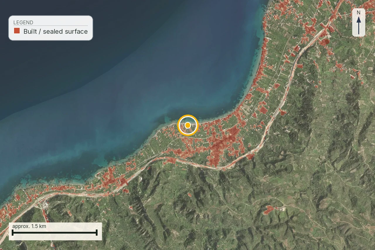
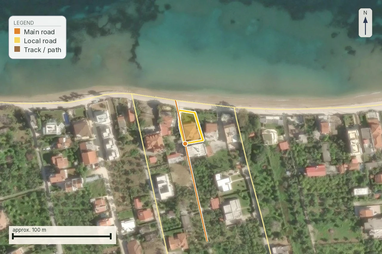
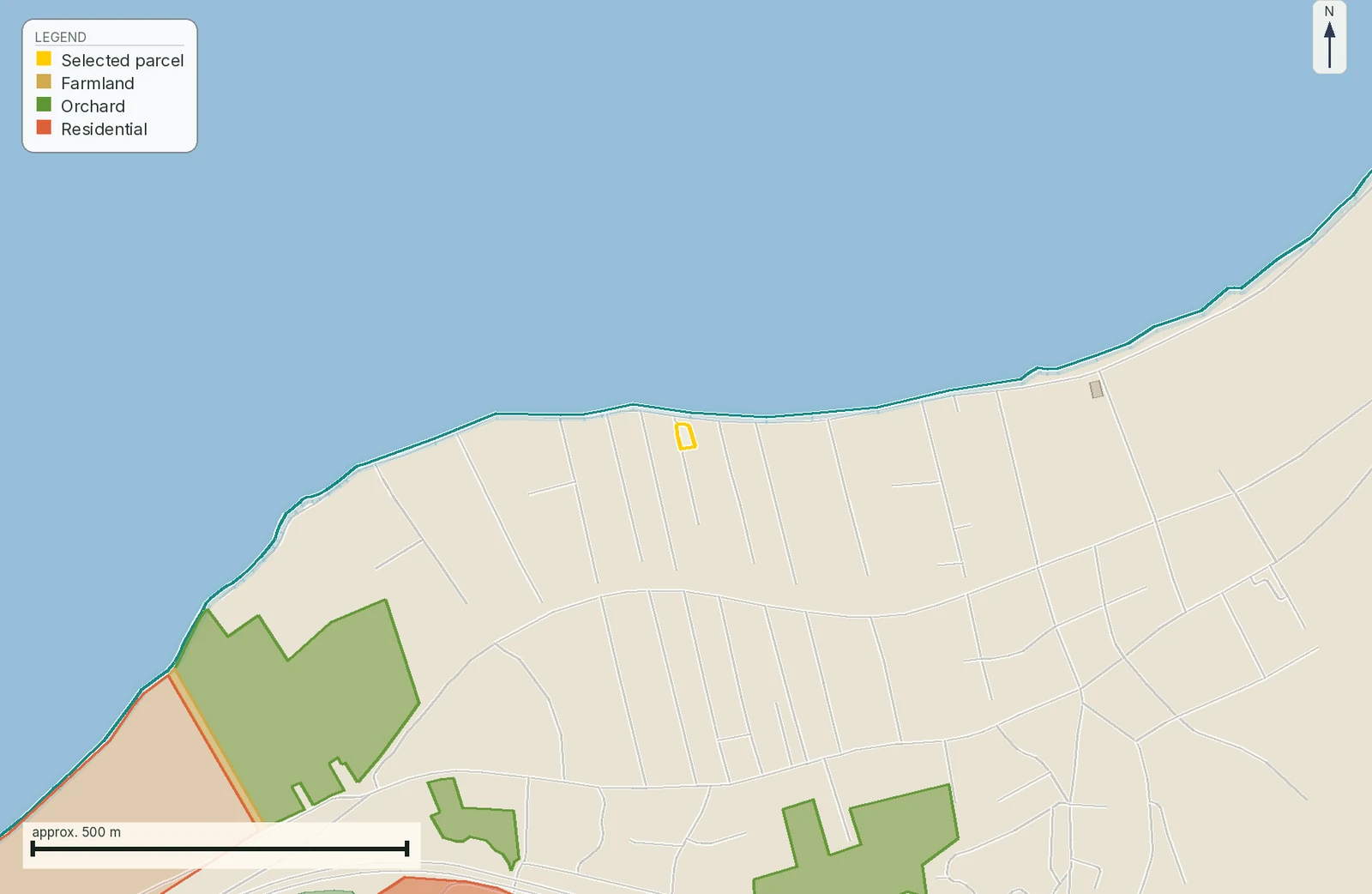
Άγιος Αρσένιος on Naxos is the parcel this guide follows most closely: 1,242 m², a 2.7% slope, a forest map that answers ΠΑ, nothing red on any hazard layer we run. Ask the planning service what may be built there and it returns ΖΟΕ Νάξου, sub-zone 1δ. The 1988 decree behind that label needs 8,000 m² before a house is allowed and this plot has 1,242 m². The same decree leaves the settlement of Άγιος Αρσένιος outside the zone, and the map service admits in its own attribute table that it never drew that exclusion. So the plot is either unbuildable or was never in the zone. No portal in Greece decides that; a named administrative act does, and the last part of this page is the letter that goes and gets it.
A plot’s αρτιότητα and οικοδομησιμότητα are the previous article’s subject: άρτιο, οικοδομήσιμο and the 4,000 m² rule. This one starts a step later. Given a plot that clears those tests, what may stand on it, and where do you read that yourself.
Four levels, and only the last has numbers
Greek planning is a stack, and a buyer meets it at the bottom: one sheet of paper with figures on it, every figure decided further up.
Level one is the χωροταξικά πλαίσια: the national strategy, the sectoral frameworks for tourism, industry, aquaculture and renewables, and one framework per region. They were άρθρα 3, 5 and 6 of ν. 4447/2016 and are now άρθρα 3, 4 and 5 of ν. 5306/2026. None of them mentions a plot. They bind the level below, which is where a buyer starts to feel them.
Level two is the one that matters for most rural purchases. A Τοπικό Πολεοδομικό Σχέδιο under άρθρο 21 ν. 5306/2026, which was άρθρο 10 ν. 4759/2020, covers one or more δημοτικές ενότητες, out-of-plan land included, and gives each zone a character and a list of permitted uses. Most of the country is still governed by the older ΓΠΣ or ΣΧΟΟΑΠ it replaces; άρθρο 21 παρ. 13 provides that wherever legislation says «Γενικό Πολεοδομικό Σχέδιο» it now means the ΤΠΣ, so the two generations are read as one instrument. Watch the name as well as the numbering. Άρθρο 7 ν. 4447/2016 created this level as a Τοπικό Χωρικό Σχέδιο (ΤΧΣ), and ν. 4759/2020 replaced that article and that name with the ΤΠΣ. A note or a glossary offering you a ΤΧΣ is using a label that was current between 2016 and 2020.
Level three, the Ρυμοτομικό Σχέδιο Εφαρμογής of άρθρο 26 ν. 5306/2026 (formerly άρθρο 13 ν. 4759/2020), draws the ρυμοτομική and οικοδομική lines and fixes the terms block by block. It exists only where a plan has been approved, which is why it is silent over open country. Level four is the only one that produces a number for your plot, and it is not a plan at all: it is the βεβαίωση όρων δόμησης the ΥΔΟΜ issues, reading down whatever binds above it.
Then there are the instruments that sit sideways. A ΖΟΕ, a zone of residential control now governed by άρθρο 274 ν. 5306/2026 and imposed originally under άρθρο 29 ν. 1337/1983 (ΦΕΚ Α΄ 33/14.3.1983), is put in place by presidential decree over out-of-plan land around a town and carries its own subdivision minimum, its own uses and its own building terms. An Ειδικό Πολεοδομικό Σχέδιο under άρθρο 22 does the same for an area of strategic importance. On the question of how long a ΖΟΕ survives, the code is explicit: άρθρο 21 παρ. 8 folds an existing ΖΟΕ into the ΤΠΣ that covers it, and «μετά από την έγκριση των Τ.Π.Σ., οι Ζ.Ο.Ε. που έχουν ενσωματωθεί σε αυτά, παύουν να ισχύουν ως αυτοτελείς ρυθμίσεις». Until that plan is approved, the decree stands on its own. Both ΖΟΕ in this article are doing work in 2026 for exactly that reason.
Use is decided separately from size
Χρήσεις γης is answered separately from how-much, and it is the question buyers skip. A plot can pass every area and frontage test, come back clean on forest, coast and archaeology, and still be closed to the thing you intend to do on it.
The vocabulary comes from π.δ. 59/2018 (ΦΕΚ Α΄ 114/29.6.2018), now carried into άρθρα 284 and following of ν. 5306/2026. Άρθρο 284 lists the general categories and the articles after it fill each one in: αμιγής κατοικία, γενική κατοικία, πολεοδομικό κέντρο, τουρισμός – αναψυχή, κοινωφελείς λειτουργίες, παραγωγικές δραστηριότητες at low, medium and high nuisance, χονδρεμπόριο, and αγροτική χρήση at περ. ιγ. A plan picks a category for each zone, and from then the list in the code is the list, whatever the neighbours have built.
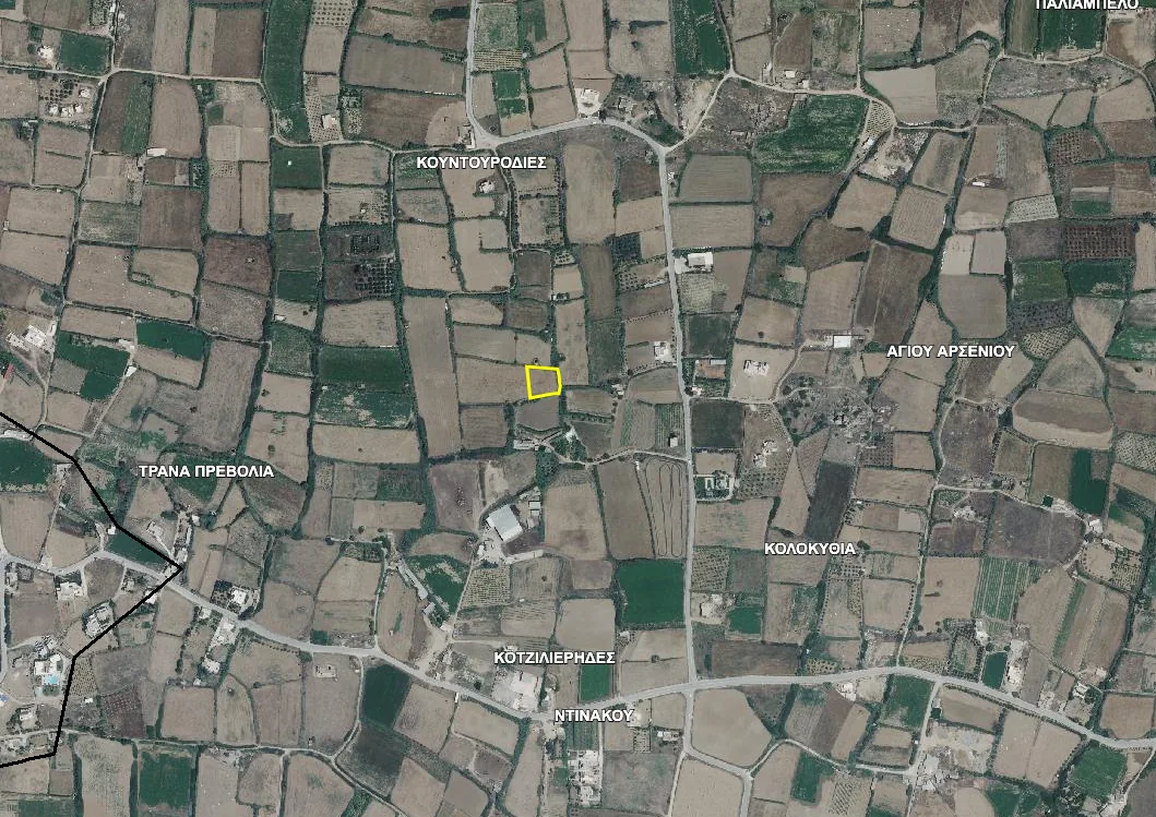
Our Trikeri parcel shows the mechanism from the other side. The general plan puts it in a zone labelled ΠΕΠ 1 – ΔΑΣΙΚΕΣ ΠΕΡΙΟΧΕΣ, special protection for forest land. That is a planning designation, held in a separate file from the forest map, which independently reads ΔΔ over the same ground. A buyer who checked one of the two would have taken it for a single finding to argue with.
The three numbers, with the arithmetic done
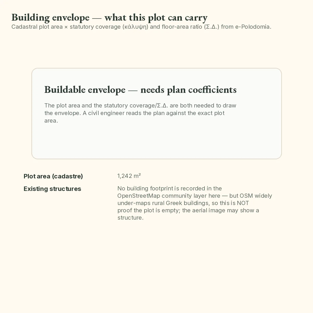
Inside an approved plan the όροι δόμησης are a longer list than a listing ever prints. The plan also fixes the ρυμοτομική and οικοδομική lines the building must sit behind, the setbacks from the other boundaries, and in many plans a storey count of its own, and the βεβαίωση carries all of them together. Three figures do the sizing, and the useful way to hold those is to run them.
- Συντελεστής δόμησης (Σ.Δ.) multiplies the plot area to give total floor area across every storey.
- Κάλυψη is the percentage of the plot the footprint may occupy.
- Μέγιστο ύψος caps the building. Under άρθρο 210 παρ. 1 ν. 5306/2026, the height table that was άρθρο 15 παρ. 1 ν. 4067/2012 (ΦΕΚ Α΄ 79/9.4.2012) before its 2014 and 2020 amendments, the cap is tied to the coefficient: 10.75 m up to Σ.Δ. 0.4, 14.00 m up to 0.8, 17.25 m up to 1.2, 19.50 m up to 1.6, 22.75 m up to 2.0 and 26.00 m up to 2.6. From 2.6 upwards the height is ten times the coefficient with 32 m as the cap, so 32 m is reached only at Σ.Δ. 3.2 and a plot at 2.8 gets 28 m. A local plan or a settlement decree may set something lower, and often does.
Those metres turn into storeys with the code’s own yardstick. Out of plan it allows two storeys under 7.50 m (άρθρο 251 παρ. 2 and 5), and inside a small settlement two storeys under the same 7.50 m (άρθρο 239), which puts a residential storey at up to about 3.75 m. Read the in-plan table on that basis and 10.75 m is roughly three storeys, 17.25 m is four to five, 26.00 m is around seven. The table caps the height and not the storey count: where a number of storeys is fixed, it is fixed by the plan or the decree, and the two limits are read together.
Notice which number bound the design in each half of that drawing. At 60% coverage the height allowance was irrelevant; at 40% the same floor area had to climb and the height rule became the constraint. Usually one of the three is the binding one and the other two have slack, but not always: a narrow plot with a low height limit can be held by coverage and height together, with the coefficient never reached. Which figure binds depends on the design as much as on the plot, so ask your engineer which of the three is doing the work in the scheme you are being sold.
Out of plan, the arithmetic changes shape
Out of plan the whole regime now sits in άρθρο 251 ν. 5306/2026, and a buyer meets two of its paragraphs at different moments. Παρ. 1 περ. α΄ sets what makes the land buildable at all: the 4,000 m² minimum and the frontage on a recognised road, worked through in the road-access article. It applies «εφόσον δεν ορίζεται διαφορετικά για κάθε περιοχή από ειδικές διατάξεις», which is the hook every ΖΟΕ decree hangs on. Παρ. 2 sets what may then be built: «ο μέγιστος συντελεστής δόμησης ανέρχεται καταρχήν σε μηδέν κόμμα δεκαοκτώ (0,18), το μέγιστο ποσοστό κάλυψης σε δέκα τοις εκατό (10%) και ο μέγιστος αριθμός ορόφων σε δύο (2)». Παρ. 5 caps height at 7.50 m above the surrounding ground, with 1.20 m more allowed for a pitched roof.
Two neighbouring paragraphs decide more designs than the coefficient does. Παρ. 4 keeps the building 15 m from every boundary, dropping to 7.50 m on the side boundaries for a dwelling on a plot that already existed on 15 April 1981 and could not otherwise be built on, and then the building may be no more than 10 m wide; it also holds a building 10 m clear of the edge of a δασική έκταση. Παρ. 6 forbids any building rising above the υδροκρίτης, which is a refusal ground on a ridge plot and does not appear on any map you can query.
For a dwelling the coefficient is not the number that binds. Floor area comes from the tapering formula of άρθρο 256 παρ. 1 περ. β΄ ν. 5306/2026, once άρθρο 33 παρ. 3 περ. δ΄ ν. 4759/2020 as amended by άρθρο 164 ν. 4819/2021: 186 m² at the 4,000 m² minimum, 258 m² at 8,000 m², and a hard ceiling of 360 m² that first bites at about 19,333 m². It rises continuously between those marks rather than in steps, and the full ladder with the percentages is in the previous article; this one is interested in what it does next to the coverage rule.
Our Lefkada parcel at Πόρος has 41,307 m². The coverage rule would allow a footprint equal to 10% of that area. The dwelling formula allows a house of 360 m². Neither the coverage rule nor the two-storey limit ever comes into play on land like that, because 360 m² under 7.50 m is a comfortable single-floor building, and a buyer who priced the land on its coverage percentage has priced something the law will not let him build.
Checking it yourself, and the address that moved
The public source is the planning stack of the Ενιαίος Ψηφιακός Χάρτης, run by the
Technical Chamber of Greece. The address engineers still circulate,
gis.epoleodomia.gov.gr/v11/, no longer holds the application. We fetched it on
1 August 2026: the secure address refuses the connection outright, the plain-HTTP one answers with a
holding page carrying the line «Γίνεται ανακατεύθυνση στην πλατφόρμα “Ενιαίος Ψηφιακός
Χάρτης” του ΤΕΕ» and a six-second refresh to sdigmap.tee.gov.gr/sdmquery/public,
and the page itself was last modified on 20 February 2026. So a bookmark from last year still works,
by a redirect that could be switched off at any time, and a link in a 2024 report may not.
The sequence is short. Open the public query application. Find your land by locality or by dropping the pin on the satellite base, checking the shape against the cadastre first so you know you are clicking the right field. Turn on the planning layers — χρήσεις γης, όροι δόμησης, αρτιότητα, ΖΟΕ, όρια οικισμών. Click inside the parcel and read the attribute panel. What you are after is the name of the act, its ΦΕΚ, and the label of the zone you have landed in.
We ran that query on all six standing parcels on 1 August 2026. Four came back with an act, and none came back with a coverage percentage, a coefficient or a height. Larissa returned the general plan for the Δήμος Λαρισαίων, ΦΕΚ Δ΄ 800 of 30 December 2019, and a zone marked «Α1».
A label like that says little until you read the act behind it, so we opened it. The gazette
is free at search.et.gr, searched by τεύχος Δ΄, number 800, year 2019, and it downloads
as a PDF. Three things came out of it that no map layer was ever going to say.
- The out-of-plan minimum in that δημοτική ενότητα is not 4,000 m². Άρθρο 2 of the act provides that across the whole Δ.Ε. Λάρισας, outside areas with an approved plan and outside the limit of a settlement under 2,000 inhabitants, «Κατώτατο όριο αρτιότητας 10.000 τ.μ., με παρέκκλιση τα 4.000 τ.μ. για όσα αγροτεμάχια είχαν το αυτό εμβαδόν την 8/10/2009». Five στρέμματα bought in that δήμο on the strength of the national 4,000 m² rule are not άρτια unless the plot already had its area in October 2009.
- «Α1» is a Ζώνη Ελέγχου και Περιορισμού της Δόμησης over the western, southern and south-eastern part of the δημοτική ενότητα, and the act says why it exists: «δεδομένου ότι στην περιοχή αυτή προβλέπεται να επεκταθεί μελλοντικά η πόλη». It is written as a list of prohibitions rather than of permissions. Livestock installations, industrial installations under άρθρο 4 π.δ. 24/31.5.1985, offices under άρθρο 5 and commercial warehouses under άρθρο 9 are all out.
- The same issue uses «Α1» for something else as well. Further down, setting in-plan uses, «Γενική Κατοικία Α1» is the zone of the Φρούριο quarter inside the city. The same label carries two different zones inside one issue. Ours should be the out-of-plan one because our parcel is out of plan, but that is a reading rather than a certainty, and until the ΥΔΟΜ answers it in writing both readings stay open. What follows about the Larissa parcel keeps that reservation.
The act does not hide the rest of the problem either. Its own title is «Διόρθωση και τροποποίηση του ΓΠΣ»: the 2019 issue gives you the corrections, and the plan they correct is in an earlier one.
Where the portal says nothing, and what binds instead
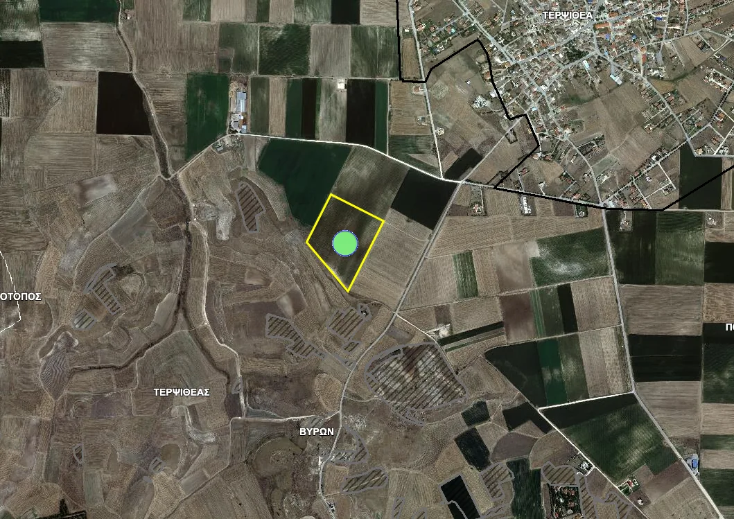
Two of the six, Πόρος on Lefkada and the second Naxos parcel, returned no planning polygon at all. That is common across rural Greece and easy to misread. Silence means no plan has been digitised over that ground. The general out-of-plan regime applies everywhere by default, and an undigitised ΖΟΕ applies whether or not anyone has drawn it into a map service.
The binding fallback is the same in every one of these cases: the έγγραφη βεβαίωση όρων δόμησης of the ΥΔΟΜ, applied for by your engineer and naming your plot. It is not an article of its own but a step inside the permit procedure, at άρθρο 324 παρ. 2 περ. β΄ ν. 5306/2026 (formerly άρθρο 38 παρ. 2 ν. 4495/2017), and that provision matters in three respects: the ΥΔΟΜ must issue it within ten days of the application, it states the terms in force at the location and checks the τοπογραφικό, and it travels with a declaration from the engineer that nothing in the area has changed since. It is the nearest thing in Greek practice to a binding statement of what you may build.
Reading the ΦΕΚ that actually binds
Take the Naxos decree as the worked example. Π.δ. 13.10.1988 (ΦΕΚ Δ΄ 846/24.11.1988) established the ΖΟΕ over out-of-plan land around Νάξος and the communities of Γαλανάδου, Γλινάδου, Βίβλου and Αγίου Αρσενίου. Άρθρο 1 draws the boundary. Άρθρο 2 divides it into sub-zones and gives each its uses, its subdivision minimum and its terms. Άρθρο 3 adds rules across the whole zone, and άρθρο 4 lists what the zone leaves out.
We read it in the gazette. Until 1 August 2026 our own note for this parcel rested on an
engineering site’s transcription, technologismiki.com, which is what the profession
uses and is not a source of law; that day we pulled the issue itself from the National Printing
House, eight scanned pages, the decree running from page 8730 to page 8732 with its 1:25,000 diagram
sheet printed at page 8733. The transcription turned out to be faithful. The gazette carried three
things our note did not have: άρθρο 4, the exact wording of
the derogation, and the diagram. All three matter below. Άρθρο 4 was checked again against that
same transcription on 2 August 2026 and reads the same, with the settlement names written out in
full there and abbreviated in the gazette.
Sub-zone 1δ is agricultural land of high productivity before it is anything else. It permits a dwelling, along with utility installations, pumping gear, water tanks, wells, stores, greenhouses and farm buildings. It sets a subdivision and buildability minimum of 8,000 m², with a derogation for plots that already held 4,000 m² on the day the decree was published. And for a dwelling it fixes a maximum total floor area of 200 m² and a maximum height of 7.50 m, figures that stand in this zone in place of the general tapering formula.
Άρθρο 3 is what a buyer misses. Across the entire ΖΟΕ it bars building within 100 m of the αιγιαλός, caps the above-ground volume of any building at 900 m³, sends every permit through the architectural review committee, requires form and materials to follow local tradition, and forbids prefabricated cabins and buildings raised on pilotis. None of that appears in a map layer, and all of it would land on a buyer who had priced a three-storey house with a garage underneath.
Three habits make a ΦΕΚ readable. Find your sub-zone first, because reading the wrong one is the standard mistake. Read the general article last and in full, because it overrides. Treat every derogation date as literal: the 4,000 m² derogation here attaches to plots that already had that area on 24 November 1988.
What that decree does to our own parcel
Now put the pieces together on ΚΑΕΚ 290021001061. The portal places it in sub-zone 1δ. The decree that governs sub-zone 1δ needs 8,000 m², or 4,000 m² held on 24 November 1988. The parcel has 1,242 m². On the face of the decree, if the ΖΟΕ reaches this plot then no dwelling may be built on it at all. The 200 m² and the 7.50 m never come into play, because the plot is not άρτιο under the zone in the first place.
Άρθρα 1 and 4 of the same decree keep that from being the end of it. Άρθρο 1 draws the zone over land outside approved plans and outside the limits of settlements existing before 1923. Άρθρο 4 is blunter still: «Στα όρια της Ζ.Ο.Ε. δεν περιλαμβάνονται οι οικισμοί κάτω από 2.000 κατοίκων, Αγ. Προκοπίου, Αγ. Άννας, Αγ. Αρσενίου, Γλιναδίου, Αγχιδίας, όπως τα όρια τους καθορίζονται με αποφάσεις του Νομάρχη σύμφωνα με τις διατάξεις του από 24.4.1985 π.δ/τος (ΦΕΚ 181/Δ)». Five settlements are named and ours is the third of them. The same άρθρο goes on to leave the ακρωτήριο Αγίου Γεωργίου and the ιδιοκτησία ΤΑΑ out of the zone as well, and to put any δασική έκταση inside it under ν. 998/1979. The two articles are doing different work: άρθρο 1 keeps the zone off pre-1923 settlement land as a class, while άρθρο 4 names five settlements and sends you to a separate απόφαση Νομάρχη for each one’s boundary. The decree tells you which document draws the line and does not draw it.
Then read the portal’s own attribute table. The ΖΟΕ record over this parcel carries a comment field: «ΛΟΓΩ ΚΑΚΗΣ ΠΟΙΟΤΗΤΑΣ ΔΙΑΓΡΑΜΜΑΤΟΣ ΔΕΝ ΑΦΑΙΡΕΘΗΚΕ ΜΕΡΟΣ ΤΩΝ ΟΙΚΙΣΜΩΝ ΟΠΩΣ ΟΡΙΖΕΤΑΙ ΑΠΟ ΤΟ ΦΕΚ». The settlements the ΦΕΚ excludes were left inside the digitised polygon because the diagram was too poor to trace. The gazette shows what that diagram is: άρθρο 1 fixes the zone by a coloured original at 1:25,000, certified by the head of the Διεύθυνση Τοπογραφικών Εφαρμογών under πράξη 61109/1988, of which only a summary copy is printed with the decree, and that copy is the sheet at page 8733. The service is telling you, in its own data, that its boundary is wrong in a known direction, and the exclusion of Άγιος Αρσένιος is exactly what went missing.
So there are two readings, they point opposite ways, and nothing a map service holds decides between them.
How the wrong line gets put right
This is the part a buyer needs and almost no page carries: the error above is correctable, and the correction has a named document, a named office and a clock on it.
Who keeps the line. Not the map service. The boundary of a settlement of this kind is fixed by an administrative act of its own, and the ΖΟΕ decree names the family it belongs to: decisions of the Νομάρχης under π.δ. της 24.4/3.5.1985 (ΦΕΚ Δ΄ 181), published in τεύχος Δ΄ like every planning act. Since then the ground has moved twice. Ν. 5306/2026 gathered settlement delimitation and settlement terms into άρθρα 226 to 248, and the criteria decree of 11/15.4.2025 (ΦΕΚ Δ΄ 194) put re-delimitation on a new footing by presidential decree per settlement. Άρθρο 247 παρ. 3 of the code is the one that decides which regime you are under today: until the decree re-delimiting your particular settlement is published, the older delimitation and the older terms keep running. On 1 August 2026 that is the position for most of Greece, and it means the operative line for Άγιος Αρσένιος is still a 1980s act.
Kallikratis, ν. 3852/2010, abolished the elected prefectural authorities from 1 January 2011. Article 283(3) transfers their general competence to the Regions but expressly excepts forest and spatial-planning or urban-planning matters, including settlement delimitation, which pass to the Decentralised Administration; for Άγιος Αρσένιος, that is the Decentralised Administration of the Aegean, distinct from the elected Region of South Aegean.
What we could not find, and what we tried. We did not locate that act. The gazette search
at search.et.gr indexes 1980s τεύχος Δ΄ issues by number and year rather than by
settlement name, and the issues themselves are scans without searchable text, so «Άγιος Αρσένιος» is
not a query the archive can answer; the planning layers draw no settlement boundary over that ground
at all; and the decree itself names the route without naming the issue. Where the act is held is not
in doubt, though. It is in the file of the ΥΔΟΜ of the Δήμος Νάξου και Μικρών Κυκλάδων, which
is where the request goes.
The application. A written request, filed at the ΥΔΟΜ’s πρωτόκολλο, naming ΚΑΕΚ 290021001061 and asking three things: the act that delimits the οικισμός of Άγιος Αρσένιος and the ΦΕΚ it was published in; whether this parcel falls inside or outside that boundary; and, if outside, whether the ΖΟΕ of π.δ. 13.10.1988 sub-zone 1δ applies to it. It costs a stamp, it can be filed by you or by your engineer, and it wants no lawyer.
The clock. Nothing in the planning code sets a deadline for that answer, so the general rule of administrative procedure does: άρθρο 4 παρ. 1 ν. 2690/1999 (Κώδικας Διοικητικής Διαδικασίας), as replaced by άρθρο 11 παρ. 1 ν. 3230/2004 and άρθρο 6 παρ. 1 ν. 3242/2004, gives the service fifty days from a complete application, sixty where more than one service has to be asked, and παρ. 2 obliges it to tell you in writing at least five days before the deadline if it is going to miss it. Silence past the deadline is a refusal you can move against rather than a reason to keep waiting.
The binding version. The letter above gives you an answer. What binds is the έγγραφη βεβαίωση όρων δόμησης of άρθρο 324 παρ. 2 περ. β΄ ν. 5306/2026, applied for through an engineer and issued within ten days, because it states the terms in force at the location of your plot and checks the τοπογραφικό with them. Ask for the settlement boundary to be answered in it by name.
If the answer is wrong, or does not come. An act or omission of the ΥΔΟΜ in the permit process is appealed to the ΠΕ.ΣΥ.ΠΟ.Θ.Α. of the περιφέρεια under άρθρο 459 παρ. 5 and 6 ν. 5306/2026, which carries over άρθρο 23 ν. 4495/2017. Four details decide these appeals more often than the merits: thirty days, an αποκλειστική deadline that cannot be extended; filed at the πρωτόκολλο of the same ΥΔΟΜ that refused you, not at the ΠΕ.ΣΥ.ΠΟ.Θ.Α., which is the classic way to lose it; a παράβολο of 50 euro or the appeal is inadmissible; and a hearing set within thirty days of the file arriving, with the decision inside thirty days of the hearing.
What none of that fixes. The polygon in the map service stays wrong. We found no public procedure by which a citizen has an over-reaching ΕΨΧ planning polygon corrected, and we are not going to invent one: the layer is a depiction of the acts, not an act, and the ΥΔΟΜ answer overrides it on your plot without changing it on the screen. The durable repair is the plan. When a Τοπικό Πολεοδομικό Σχέδιο covering Νάξος is approved, άρθρο 21 παρ. 8 folds this ΖΟΕ into it and the 1988 decree stops applying as a standalone instrument, boundary error and all. That is a public process with consultation stages, not an application, and it runs in years.
Terms documents that describe a year that has passed
A superseded terms document is more dangerous than a missing one, because it looks like an answer. It arrives in three forms.
- The plan act that is itself an amendment. The act returned for our Larissa parcel is titled «Διόρθωση και τροποποίηση του ΓΠΣ». Reading only the 2019 ΦΕΚ gives you the changes without the plan they change.
- The renumbering. Ν. 5306/2026, the Κώδικας Χωροταξίας – Πολεοδομίας «Νικόλαος Ταγαράς» (ΦΕΚ Α΄ 88/8.6.2026), pulled the building code, the planning instruments and the out-of-plan regime into one text. The height table that was άρθρο 15 ν. 4067/2012 is now άρθρο 210; the general out-of-plan terms are άρθρο 251; the dwelling formula is άρθρο 256; the ΤΠΣ is άρθρο 21 and the ΖΟΕ άρθρο 274. A note citing the old numbers is usually right on substance while pointing at a replaced text.
- The terms box on an old τοπογραφικό. Surveyors print the terms in force on the day they draw. A 2015 sheet carries 2015 terms and will be handed to you in 2026 with complete confidence.
The defence is one line in the request. Ask for the terms in force on the date of the certificate, with the ΦΕΚ of each act relied on, amendments included.
Reading a listing, phrase by phrase
| What it says | What to ask |
|---|---|
| “Buildable, Σ.Δ. 0.4” | Inside a plan or out of it? Out of plan a coefficient does not size a dwelling. |
| “You can build 200 m²” | Under which provision. Two different pedigrees end at 200 m²: the pre-2020 general out-of-plan figure, and on Naxos the cap άρθρο 2 of π.δ. 13.10.1988 sets for a dwelling in sub-zone 1δ. The Naxos figure only reaches a plot that is in the zone and meets its 8,000 m² minimum. |
| “Zone Α1 / ΠΕΠ 1” | Which ΦΕΚ defines the label, and what does the text say the zone permits? The label alone carries no content. |
| “Outside the ΖΟΕ” | Against which boundary: the digitised polygon, or the diagram published with the decree and the settlement limits the decree excludes? |
What to ask for, in order
- Run the free query yourself. Twenty minutes on the Ενιαίος Ψηφιακός Χάρτης gives you the act and the zone label, and it costs nothing to be wrong.
- Open the ΦΕΚ the act points at and find your sub-zone. Almost nobody takes this step, and it is where the binding numbers live.
- Put the boundary question in writing wherever a zone edge runs near your plot, naming the ΚΑΕΚ and the boundary you want located. This is the step that would settle our Naxos parcel.
- Commission the έγγραφη βεβαίωση όρων δόμησης through an engineer, asking for the acts and their amendments by ΦΕΚ, and for the terms as in force on the date of issue. Άρθρο 324 παρ. 2 περ. β΄ ν. 5306/2026 gives the ΥΔΟΜ ten days from the application. That is the deadline the code sets, not a measurement of how long any particular office takes, so file it as early in the purchase as the engineer can and read the ten days as the point from which you are entitled to chase it.
- Put the permitted uses in writing for the use you intend, whether a dwelling, a short-let, a warehouse or a tourist unit. They are answered separately.
The Naxos parcel is where this guide started and it is still open. It is clean on forest, coast, slope and every hazard layer we run, and its area is measured. The question of building at all on it turns on a pre-1923 settlement line held on paper at the ΥΔΟΜ of Νάξος and drawn on no map service. Step three above is the letter that asks for it. We have not filed it: we are not a party to any purchase of this parcel, and the request belongs to whoever is, or to the engineer acting for them. What we can put on the page is the act to cite, the office that holds the file, the three questions and the clock that runs from the day it is stamped in.
Common questions
What is the difference between συντελεστής δόμησης and κάλυψη?
The coefficient multiplies the plot area to give total floor area across every storey; coverage is the share of the plot the footprint may occupy. A 320 m² plot with Σ.Δ. 1.2 carries 384 m² of floor area either way, but at 60% coverage that arrives as two wide storeys and at 40% as three narrow ones. They are answered together, on the same certificate.
My plot is out of plan. Does the Σ.Δ. of 0.18 give me my square metres?
Not for a dwelling. Άρθρο 251 παρ. 2 ν. 5306/2026 does set a maximum coefficient of 0.18 along with 10% coverage and two storeys, but the floor area of a house comes from the tapering formula of άρθρο 256 παρ. 1 περ. β΄ of the same code, formerly άρθρο 33 παρ. 3 περ. δ΄ ν. 4759/2020 as amended by άρθρο 164 ν. 4819/2021. It tapers rather than steps: 186 m² covers the first 4,000 m² and 1.8% of anything above that up to 8,000 m², so 6,000 m² gives 222 m²; past 8,000 m² it is 258 m² plus 0.9% of the rest, capped at 360 m² from about 19,333 m² upward. A 41,307 m² plot on Lefkada would be allowed a footprint equal to 10% of its area by the coverage rule and 360 m² of house by the formula.
Why does this page cite άρθρο 251 παρ. 2 while your road article cites άρθρο 251 παρ. 1?
Because they are different paragraphs of the same article and both are in force. Άρθρο 251 ν. 5306/2026 is headed «Γενικοί όροι και περιορισμοί δόμησης». Παρ. 1 περ. α΄ fixes what makes out-of-plan land buildable at all — the 4,000 m² minimum, the 25 m frontage, and the recognition of the road, carrying forward άρθρο 20 παρ. 15 ν. 3937/2011 as replaced by άρθρο 166 ν. 4819/2021 — and it opens with the reservation «εφόσον δεν ορίζεται διαφορετικά για κάθε περιοχή από ειδικές διατάξεις». Παρ. 2 fixes what may then be built: a coefficient of 0.18, coverage of 10% and two storeys. Παρ. 5 caps height at 7.50 m. A plot has to clear παρ. 1 before παρ. 2 means anything.
The plot is άρτιο and οικοδομήσιμο. Can a land-use zone still stop me?
Yes, and this is the gap most buyers walk into. Χρήσεις γης are decided separately from size: π.δ. 59/2018 (ΦΕΚ Α΄ 114/29.6.2018), now άρθρα 284 and following of ν. 5306/2026, sets the categories and a plan attaches one to each zone. A plot in a zone designated for agriculture or forest protection can be fully άρτιο and closed to the use you had in mind. Ask about the use you actually intend, by name.
Where do I check the planning terms for free?
The planning layers of the Ενιαίος Ψηφιακός Χάρτης, run by the Technical Chamber of Greece. The address engineers still pass around, gis.epoleodomia.gov.gr/v11/, forwards to sdigmap.tee.gov.gr/sdmquery/public as of August 2026. Click inside your parcel and read the attribute panel. It gives you the act and the zone label, and that is the point of the exercise: the act names a ΦΕΚ, and the ΦΕΚ is free at search.et.gr.
The portal shows nothing over my plot. Does that mean there are no restrictions?
No. It means no plan has been digitised over that ground. Two of our six standing parcels returned nothing at all on 1 August 2026, and both are still governed by the general out-of-plan regime, and possibly by a decree nobody has drawn into a map service. Silence in a viewer is an absence of data, and the question moves to the ΥΔΟΜ.
What is a ΖΟΕ, and what did yours do to the Naxos parcel?
A ζώνη οικιστικού ελέγχου, imposed by presidential decree over out-of-plan land around a town, now governed by άρθρο 274 ν. 5306/2026 and originally by άρθρο 29 ν. 1337/1983, with its own subdivision minimum, uses and building terms. The Naxos ΖΟΕ is π.δ. 13.10.1988 (ΦΕΚ Δ΄ 846/24.11.1988). In sub-zone 1δ its άρθρο 2 requires 8,000 m², or 4,000 m² already held on 24 November 1988, and caps a dwelling at 200 m² and 7.50 m. Our parcel has 1,242 m², so if the zone reaches it no dwelling is allowed at all. But άρθρο 1 of the same decree keeps the zone off land inside the limits of settlements existing before 1923, and άρθρο 4 names five of them that are left out — Αγ. Προκοπίου, Αγ. Άννας, Αγ. Αρσενίου, Γλιναδίου, Αγχιδίας — each with its boundary fixed by a separate decision of the Νομάρχης under π.δ. της 24.4/3.5.1985 (ΦΕΚ Δ΄ 181). The map layer admits it never cut those settlements out of its polygon. Only the ΥΔΟΜ of Νάξος can say which side of that line the plot is on, and that answer decides the purchase.
How do I avoid being shown an out-of-date terms document?
Ask for the terms as in force on the date of the certificate, and for the ΦΕΚ of every act relied on, amendments included. Three forms recur: a plan act that is itself an amendment of an earlier plan, a note citing article numbers that ν. 5306/2026 replaced in June 2026, and the terms box printed on a topographic diagram years ago. A document that names its acts can be checked; one that only gives figures cannot.
Does your report give me the coefficients?
It gives you the plot area it measured, the planning act covering the point and the zone label, each with the date it was read, and it says plainly when no coefficients are published for the area. It does not invent an envelope. The numbers come from the ΦΕΚ behind the act and are confirmed for your plot by the βεβαίωση όρων δόμησης, which only a licensed engineer can obtain on your behalf.
Keep reading
Check this on your own parcel
Pin the plot, confirm the KAEK, and every check in this guide is read against it and written up with its source and date. EUR 29 total · VAT included.