
Διαβάστε το άρθρο στα ελληνικά.
In-plan vs out-of-plan land in Greece: what you can build
On this page
Greek land sits in one of three planning regimes, and the same four στρέμματα carry 186 m² of house in one of them and several hundred in another. What draws each line, what crossing it costs in land and money, and how you establish which side a specific plot is on.
This guide is a preliminary screen for a purchase or permit question, not legal, surveying, engineering or tax advice; read the full scope and limits before relying on it.
Have a specific plot in mind? Every check in this guide can be run on it, with source and date, for EUR 29 total · VAT included. Pin it on the map →
Four στρέμματα, one buyer, three answers. Out of plan that plot carries a house of 186 m². Inside the boundary of a village it carries 400 m², and on one reading of the settlement rules considerably more. Inside a town plan that has not yet been applied on the ground, the state takes 1,250 m² of it and sends a bill for the rest.
Whether a plot is άρτιο and οικοδομήσιμο is the pillar article's subject and everything below assumes it. This one is about the line before that: which planning regime your land sits in and how to establish it for a specific parcel rather than for a village.
Three statuses; only two have a boundary
Εντός σχεδίου means inside an approved ρυμοτομικό σχέδιο: a plan that draws streets, building lines and blocks, approved by decree or ministerial act and published in the ΦΕΚ with a diagram. Εντός ορίων οικισμού means inside the delimited boundary of a settlement of up to 2,000 inhabitants, which has a boundary but no street plan. Εκτός σχεδίου is defined by subtraction. Άρθρο 251 παρ. 1 of the 2026 planning code says so in as many words: it governs plots «εκτός των ρυμοτομικών σχεδίων πόλεων ή εκτός των ορίων των νόμιμα υφισταμένων πριν από το έτος 1923 οικισμών που στερούνται ρυμοτομικού σχεδίου ή εκτός των ορίων των οικισμών κάτω των δύο χιλιάδων (2.000) κατοίκων».
Note the third limb of that sentence. A settlement predating 1923 is its own category, separate from the under-2,000 settlements, and old villages routinely fall in it. When someone tells you a plot is «στα όρια του οικισμού», the first question is which of the two kinds of settlement they mean, because the delimiting act and the terms differ.
Εντός σχεδίου requires two documents, but buyers check one
The plan says what the area will look like. The πράξη εφαρμογής is the instrument that turns it into plots on the ground, and until it is ratified the parcel in the deed is not the parcel in the plan. Άρθρο 144 παρ. 3 ν. 5306/2026, which codifies άρθρο 12 παρ. 3 ν. 1337/1983, sets out what it does: it fixes «τα τμήματα που αφαιρούνται από κάθε ιδιοκτησία για εισφορά γης», identifies what is taken for common and public space, merges or reallocates plots that cannot be made άρτια, and may change the shape and the position of a plot so that it becomes buildable.
That power matters because your land can end up somewhere else in the block. An owner who disagrees that the new plot is equivalent to the old one has six months from ratification to say so in court, under άρθρο 144 παρ. 3, and the application of the plan is not suspended while the case runs.
What the land contribution actually takes
Property coming into a plan for the first time, or into an extension of one, owes an εισφορά σε γη. The scale is progressive, it is applied slice by slice, and it is taken in ground rather than money.
Two details decide how much. First, the areas used are the areas the properties had on 28 May 2014, and later subdivisions are ignored for the calculation, so splitting a field between children in 2019 does not lower the band it falls into. Άρθρο 139 παρ. 5 says it plainly: «Κατατμήσεις που έλαβαν χώρα μετέπειτα της προαναφερθείσας ημερομηνίας δεν λαμβάνονται υπόψη».
Second, the percentages can rise. Where the contributions calculated across the whole planning unit fall short of the open space the standards require, άρθρο 139 παρ. 4 περ. στ increases the bands automatically, without a further approval. The ceilings it sets are 30% on the first two bands, 40% on the third and 50% on the fourth. Run the same 4,000 m² property at those ceilings and the contribution goes from 1,250 m² to 1,700 m², which is 42.5% of the land.
And what the money contribution charges
The εισφορά σε χρήμα is calculated on the plot as the πράξη εφαρμογής forms it and on the τιμή ζώνης in force when that act is ratified, under άρθρο 141 παρ. 1 ν. 5306/2026. It is payable over nine years in 108 monthly instalments, or 36 quarterly or 18 half-yearly ones, with a minimum monthly instalment of EUR 50, and a 20% discount for anyone who pays the whole sum within a year of assessment.
The paragraph a buyer needs is παρ. 4. A notarial deed transferring a property that owes this contribution must have attached a certificate from the δήμος that at least 30% of the total has been paid, and the deed must state, on pain of nullity, who owes the balance and how much is left. The debt follows the land, and the notary is the point at which it surfaces.
Read one more line of the same article before assuming a village plot is outside all of this. Άρθρο 139 παρ. 2 allows the authority that approves the ρυμοτομικό σχέδιο, after the municipal council's opinion, to bring properties inside a settlement of up to 2,000 inhabitants under the contribution provisions. That takes a decision of its own, and the question to the δήμος is whether one has been taken for this settlement.
The ownership filing that can void your purchase, and how to cure the nullity
A πράξη εφαρμογής does not finish when it is ratified. Every owner inside its boundary then owes the δήμος a δήλωση ιδιοκτησίας, an ownership declaration, under άρθρο 144 παρ. 5(α) ν. 5306/2026. Nothing on a map or a title deed shows whether it was filed, so a buyer coming from outside Greece has no way to guess the term even exists.
Without the δήμος's certificate that the declaration was filed, «Κάθε δικαιοπραξία εν ζωή είναι άκυρη» (every inter-vivos transaction is void by law), and no building permit is issued either. That sentence is real and it is current law. The same paragraph then cures it. The nullity is remedied by filing the declaration afterwards, with a one-off fine on whoever should have filed and did not. So a missing declaration is a condition to close before completion, not a reason to abandon the purchase. What this research could not establish is the size of that fine, or who carries it where the person who failed to file is a predecessor in title rather than the seller now standing in front of you; ask the δήμος for both, in writing, before signing.
The predecessor of this rule, άρθρο 12 παρ. 5 περ. 1α ν. 1337/1983 as amended by άρθρο 5 παρ. 4 ν. 2242/1994, made the same nullity absolute and incurable: a deed signed without the certificate was permanently void, with no cure and no compensation. The Plenary of the Areios Pagos struck that down in ΟλΑΠ 9/2022, holding it disproportionate under Article 1 of the First Additional Protocol to the ECHR and Article 25 of the Constitution, because a milder measure existed: a penalty that lifts once the declaration is filed. The cure now written into άρθρο 144 παρ. 5(α) is that milder measure. The legislature answered the judgment, which is why the rule you are reading today gives you a way back that the 1983 version never did.
The obligation fell on whoever owned the property when the act was ratified, usually years or decades before the plot reached the market, so the person selling it to you may not know whether their own filing, or a parent's, was ever made. Ask the technical service of the δήμος that ratified the πράξη εφαρμογής whether the declaration is registered under the current owner's name, in writing, before signing anything. A declaration filed under the wrong name is corrected the same way as the act itself: an application to the δήμος, not a court filing. Court is needed only where someone else is claiming the same plot.
The settlement boundary and its changing regime
Settlements of up to 2,000 inhabitants were delimited under the π.δ. της 24.4/3.5.1985 (ΦΕΚ Δ´ 181). Άρθρο 1 of that decree defines the class by census: any distinct settlement recorded in the last census with up to 2,000 inhabitants, whatever the population of the municipality it belongs to. Άρθρο 5 then sets the terms, and the αρτιότητα comes as a range fixed settlement by settlement: «θεωρούνται άρτια τα οικόπεδα με ελάχιστο εμβαδόν αρτιότητας που μπορεί να κυμαίνεται από 300 μέχρι 2.000 m2», with frontage of 10 m up to 500 m² and 15 m above it. Until you know which figure was fixed for that particular settlement, you do not know whether a 600 m² plot there is άρτιο.
In 2025 the framework was rewritten. A presidential decree of 11/15.4.2025 (ΦΕΚ Δ´ 194) set new criteria for delimiting these settlements, and άρθρο 63 ν. 5215/2025 (ΦΕΚ Α´ 116/4.7.2025) created two new categories. Both are now inside the planning code: άρθρα 226 to 248 ν. 5306/2026 carry the whole settlement regime, with άρθρο 228 on the categories of settlement, άρθρο 233 on approval of a delimitation, άρθρο 237 on αρτιότητα, άρθρο 238 on coverage and coefficient, άρθρο 239 on height, and άρθρο 234 on the two 2025 creations, Ζώνη Ανάπτυξης Οικισμού (Ζ.Α.Ο.) for settlements up to 700 inhabitants and Περιοχή Ειδικών Χρήσεων (Π.Ε.Χ.) for those of 701 to 2,000.
None of it bites until your settlement is re-delimited. The code says so in two places and a buyer wants both. The express one is άρθρο 247, the closing article of the settlement chapter. Παρ. 2 stops the ΥΔΟΜ applying the new chapter directly to a permit before the settlement's own delimitation decree exists. Παρ. 3 keeps the corresponding provisions of the Κώδικας Βασικής Πολεοδομικής Νομοθεσίας (π.δ. της 14/27.7.1999, ΦΕΚ Δ´ 580) and the individual decrees running «έως την έκδοση του προεδρικού διατάγματος οριοθέτησης εκάστου οικισμού». Παρ. 4 then lists what stops applying on the day that decree is published, which is the list to read if your settlement has just been re-delimited.
Άρθρο 245, the transitional article, handles the two loose ends: delimitation procedures already pending on 15 April 2025 may be completed under the earlier provisions, and permits already issued stand and may be revised. One rule from the new chapter binds everywhere today whatever the state of delimitation, because άρθρο 247 παρ. 2 excepts it by name: άρθρο 242 παρ. Δ περ. 1 keeps a Category A industrial or craft installation, or any generally polluting one, 500 m clear of a settlement boundary. That is a real answer to «what could be built next to me» in a village that has not been touched since 1985.
So each settlement needs its own decree first. On 1 August 2026 the 1985 terms still govern almost everywhere, and the practical question is two-part: has this settlement been re-delimited, and if so into which zone.
What a settlement plot may carry
The numbers are generous by comparison with open country, and the cap is expressed in an unusual way: as a flat ceiling in square metres of floor area, which a large plot reaches and then stops at.
- Under the 1985 decree, coverage is 60%; an οικόπεδο under 700 m² may carry 240 m² of any use plus a 40 m² mezzanine, and one of 700 m² or more may carry 400 m². Maximum height 7.50 m, raised by 2.00 m where a pitched roof is imposed on the settlement.
- Under the code, Ζώνες Β and Β1 keep those figures at άρθρο 238 παρ. Β.2. Ζώνη Α, the dense core, gives 400 m² up to 2,000 m² of plot and then 400 + (plot area − 2,000) × 0.05, so 4,000 m² carries 500 m². Two storeys, 7.50 m, with a third storey allowed on sloping ground without exceeding the coefficient.
- Άρθρο 5 παρ. 6 of the 1985 decree carries a provision that rewards not subdividing. A buildable οικόπεδο of at least 1,800 m² with frontage on a lawful common space, left undivided, may build the sum of what the plots a lawful subdivision would produce could each carry, reduced by 10% and following the settlement's traditional architecture. Take the same four στρέμματα in a settlement whose αρτιότητα has been fixed at 1,000 m²: a lawful subdivision would give four οικόπεδα, each entitled to 400 m², so the undivided title carries 1,600 m² less 10%, or 1,440 m². The 1,800 m² is the entry threshold for the provision; the worked figure needs the full four στρέμματα and an αρτιότητα of 1,000 m², and both are assumptions of ours. We did not establish whether the code carries an equivalent for re-delimited settlements (άρθρο 243, «Ειδικοί όροι και περιορισμοί δόμησης», we did not open), so put the figure to the ΥΔΟΜ rather than assume it.
Those 1985 figures deserve the same treatment as the 2026 ones on this page. They are άρθρο 5 παρ. 1, 2, 4 and 6 of the π.δ. της 24.4/3.5.1985 (ΦΕΚ Δ´ 181/3.5.1985), with παρ. 2 in the form given to it by the π.δ. της 4.11.2011 (ΦΕΚ ΑΑΠ 289). That 2011 replacement is where the 60% and the 240/400 m² come from; the 1985 text as first published said something else. We read them in the consolidated version at technologismiki.com on 1 August 2026 and not in the Δ´ 181 gazette itself, which we could not obtain. The code figures beside them come from άρθρα 237, 238 and 239 ν. 5306/2026, read the same day.
Out of plan, the envelope is national and the shape decides
Άρθρο 251 ν. 5306/2026 sets the general terms: minimum plot 4,000 m² with 25 m of frontage on a common road; maximum Σ.Δ. 0.18, coverage 10% and two storeys; maximum height 7.50 m from the surrounding ground, raised by 1.20 m for a pitched roof; and a rule you will not find in any listing, παρ. 6, forbidding a building to rise above the υδροκρίτης, the watershed line.
For a dwelling the Σ.Δ. never becomes the operative number. Άρθρο 256 παρ. 1 περ. β gives the floor area directly: 186 m² for the first 4,000 m² plus 1.8% of the area between 4,000 and 8,000; 258 m² for the first 8,000 plus 0.9% above that; and «μη δυναμένη σε καμία περίπτωση να υπερβεί τα τριακόσια εξήντα (360) τ.μ.». Read it as a taper and not as three step values, because the difference is a room: 6,000 m² carries 222 m², 10,000 m² carries 276 m², and the 360 m² ceiling only starts to bite at about 19,300 m².
Older sources give that formula as άρθρο 33 παρ. 3 περ. δ ν. 4759/2020 (ΦΕΚ Α´ 245/9.12.2020), and until June 2026 that was the right address. It has stopped being one. Άρθρο 477 of the code repeals the provisions listed in its Παράρτημα Α´, and Παράρτημα Α´ maps άρθρο 256 παρ. 1 onto, among other things, «την περ. δ) της παρ. 3 του άρθρου 33 του ν. 4759/2020, το οποίο τροποποιήθηκε με το άρθρο 164 του ν. 4819/2021». Two things follow from that one line. The 2020 provision was repealed on 8 June 2026, so the live citation is άρθρο 256 παρ. 1 περ. β and the old number belongs in brackets behind it. And what the code carried forward is the 2021 text: άρθρο 164 ν. 4819/2021 (ΦΕΚ Α´ 129/23.7.2021) had already rewritten the first band from plots «μεγαλύτερου των 4.000 τ.μ.» to plots of «4.000 τ.μ. μέχρι και 8.000», which is what puts a plot of exactly four στρέμματα inside it rather than just outside. A note that quotes the 2020 wording bare is quoting a band that moved in 2021, under a number that was repealed in 2026.
Άρθρο 256 παρ. 1 περ. β υποπερ. βγ then does out of plan what παρ. 6 of the 1985 decree does inside a settlement, and it is better known to engineers than to buyers. A plot whose area is a multiple of 4,000 m² and which could lawfully be subdivided may instead build the sum of what each resulting plot would carry, reduced by 15%, provided one building goes up and the plot stays undivided. Transfers in breach of those conditions are «αυτοδικαίως άκυρες». On 8,000 m² that is 2 × 186, less 15%, or 316 m², against 258 m² from the ordinary formula.
The distances of άρθρο 251 παρ. 4 do more damage than the floor-area formula. Παρ. 4α sets fifteen metres from every boundary and that is the rule. Παρ. 4β lowers the side distances to 7.50 m, but only when four things hold at once: the building is a dwelling, the plot is at least 4,000 m², the plot already existed on 15 April 1981 (π.δ. της 27.3/15.4.1981, ΦΕΚ Δ´ 209), and the fifteen-metre rule would otherwise leave it impossible to build on. The relief exists to rescue a plot that has no envelope at all, and the building is then capped at 10 m in width. Παρ. 4γ overrides παρ. 4β and keeps fifteen metres from a railway expropriation zone and ten from the edge of a forest area. So a 4,000 m² plot thirty metres wide has nothing left after παρ. 4α, and whether παρ. 4β rescues it turns on a date in 1981 and on the ΥΔΟΜ accepting that there is no other way to place a house on it.
The same four στρέμματα, six ways
| Εντός σχεδίου | Εντός ορίων οικισμού | Εκτός σχεδίου | |
|---|---|---|---|
| Minimum plot | Set by the plan. No national figure | 300–2,000 m², fixed per settlement | 4,000 m² |
| Frontage | On a plan road | 10 m to 500 m², 15 m above | 25 m on a common road |
| Dwelling on 4,000 m² | Plan coefficient × the plot the πράξη εφαρμογής leaves | 400 m², or 500 m² in Ζώνη Α | 186 m² |
| Coverage | Set by the plan | 60% | 10% |
| Setback | Building line in the plan | 2.50 m, or built to the boundary | 15 m from every side |
| What it costs to get there | Up to 42.5% of the land, plus a money contribution over nine years | Nothing, unless the δήμος opts the settlement into the contributions | Nothing |
| How long | Until the πράξη εφαρμογής is ratified. The code still legislates for procedures pending since before 2025 | Today's terms hold until that settlement's own delimitation decree is published | Immediate, unless a παρέκκλιση is involved |
Two rows in that table carry the argument for settling the status before agreeing a price. The cheapest land carries the smallest house. The land that carries the biggest house has paid for the privilege with 31.25% of its area, and with nine years of instalments on top.
Old plots, old rights and the date that keeps moving
A plot smaller than 4,000 m² out of plan is being sold on the strength of a παρέκκλιση, and the tiers themselves are set out in full in άρτιο, οικοδομήσιμο and the 4,000 m² rule. Three boundary points belong here.
The first is a date that decides whether any of the tiers still exist for a given plot, and the code never prints it as a date, which is why buyers miss it. Άρθρο 273 παρ. 1 opens by allowing the old derogations only where, «μέχρι την έγκριση Τοπικού Πολεοδομικού Σχεδίου (Τ.Π.Σ.) ή Ειδικού Πολεοδομικού Σχεδίου (Ε.Π.Σ.) και πάντως για χρονικό διάστημα που δεν υπερβαίνει τα δύο (2) έτη από την 9η.12.2020, ημερομηνία έναρξης της ισχύος του ν. 4759/2020 (Α´ 245)», an application had already been filed, either for a προέγκριση οικοδομικής άδειας with the studies of άρθρο 321 παρ. 5, or for the ΥΔΟΜ's written βεβαίωση under άρθρο 324 παρ. 2 περ. β υποπερ. βα. Two years from 9 December 2020 is 9 December 2022, and that is where the date comes from. Nothing lodged after it opens the window. The 30 June 2027 date extends the life of a file that was already inside it, which is why the useful question to a seller is the protocol number and the stamped date on that 2022 filing, and not whether the plot "is buildable".
The second is that άρθρο 273 ties the derogations to frontage on a classified road, and παρ. 1 περ. γ ties one of them to the plot being «εντός της ζώνης των πόλεων, κωμών και οικισμών» on 24 April 1977. A derogation can therefore depend on a settlement zone as it stood almost fifty years ago, and no current portal draws that line.
The third is a gap we cannot close from the text. The move from 30 June 2026 to 30 June 2027 was made by άρθρο 133 ν. 5317/2026 (ΦΕΚ Α´ 108/10.7.2026), whose own title is «Παρατάσεις πολεοδομικών προθεσμιών - Τροποποίηση παρ. 1 άρθρου 273», and which replaces the words «30ή Ιουνίου 2026» with «30ή Ιουνίου 2027». That gazette is dated ten days after the date it extends. We cannot tell from the text whether the provision was revived or whether a file lodged in the first fortnight of July was ever at risk, and we are not going to guess. Put the question to your engineer with ΦΕΚ Α´ 108/10.7.2026 in front of you, and ask for the answer in writing if the seller's file was lodged inside those ten days.
Establishing the status of one parcel
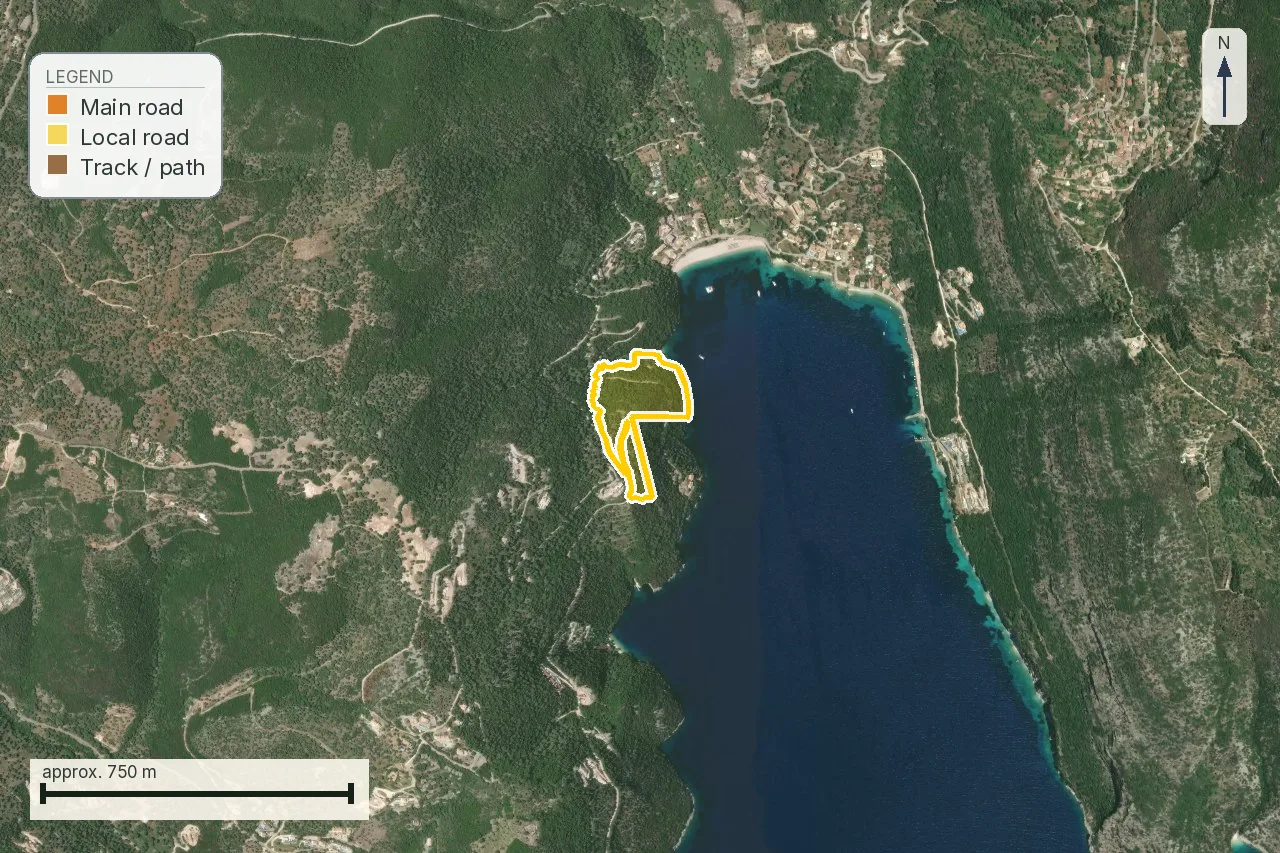
Start with the planning stack of the Ενιαίος Ψηφιακός Χάρτης. Querying it layer by layer is set out in όροι δόμησης and χρήσεις γης. What you are looking for on the status question is narrow: an approved ρυμοτομικό σχέδιο over the point, an όριο οικισμού polygon, or neither.
A free viewer can mislead here. A viewer that returns no polygon has told you only that nothing has been digitised over that ground. It has said nothing about what governs it. Delimitation acts from the 1980s still exist on paper for settlements no map service has ever drawn, and a plot can sit comfortably inside one while every portal shows open country.
The binding answer is the written βεβαίωση όρων δόμησης of the ΥΔΟΜ under άρθρο 324 παρ. 2 περ. β υποπερ. βα ν. 5306/2026, which codifies άρθρο 38 παρ. 2 ν. 4495/2017 (ΦΕΚ Α´ 167/3.11.2017). Read the paragraph before you ask for it, because it tells you what you are entitled to. The service writes down the building terms in force at the position of the property and the approvals other bodies will have to give, and it checks your τοπογραφικό διάγραμμα against them. It «εκδίδεται εντός δέκα (10) ημερών από την υποβολή της σχετικής αίτησης», so an office that takes three months is outside the provision and can be told so in writing. And it travels with a υπεύθυνη δήλωση of the designing engineer under άρθρο 8 ν. 1599/1986 confirming that the terms in the area have not changed since it was issued, which is what makes a certificate from two years ago useless on its own.
Ask for it in terms that name the status: which regime governs the plot, under which act and ΦΕΚ, and where the boundary of that regime runs against the plot's own boundaries. A certificate that gives you coverage and a coefficient without saying which regime produced them cannot be checked.
If it comes back wrong, there is a route and the window is short. A διοικητική προσφυγή against an act or an omission of a ΥΔΟΜ in the course of issuing a permit, a δόμηση licence or a προέγκριση goes to the Περιφερειακό Συμβούλιο Πολεοδομικών Θεμάτων και Αμφισβητήσεων (ΠΕ.ΣΥ.ΠΟ.Θ.Α.) under άρθρο 459 παρ. 5–6 ν. 5306/2026. Thirty days, «αποκλειστική προθεσμία», counted from service or from the day you otherwise obtained full knowledge of the act; a EUR 50 παράβολο, without which it is inadmissible; and it is filed at the protocol of the very ΥΔΟΜ that issued the act, which then forwards it. Taking it straight to the ΠΕ.ΣΥ.ΠΟ.Θ.Α. is the usual way of losing the thirty days. The hearing is then set within thirty days of arrival and the decision follows within thirty of the hearing. Do not reach for άρθρο 378, the one article in the code actually headed «Προσφυγή»: that belongs to the αυθαίρετα chapter and challenges an έκθεση αυτοψίας.
Where the provisions moved in June 2026
Renumbering matters here because buyers research planning status through old sources. A 2021 forum answer citing άρθρο 40 ν. 4759/2020, a surveyor's note citing άρθρο 8 ν. 1337/1983, a lawyer's letter citing the 1985 decree: all three are pointing at text that has been carried into the code and, in the settlement case, substantially rewritten on the way.
Reading a listing, phrase by phrase
| What it says | What to ask |
|---|---|
| “Inside the village” | Inside which line, drawn by which act, published in which ΦΕΚ? A house fifty metres away proves nothing about the boundary. |
| “Εντός σχεδίου” | Has the πράξη εφαρμογής been ratified? If not, how much land does the contribution take and what is outstanding on the money contribution? |
| “Buildable, 4 στρέμματα” | Out of plan 4,000 m² is the statutory floor, so a survey coming in at 3,940 m² ends the conversation. What is the frontage, and what is the plot's width against a 15 m setback? |
| “The plan is coming” | Incorporation into a plan costs land and money, so a price that already banks the plan is charging you for your own contribution. |
| “1,200 m² and buildable” | On which παρέκκλιση, and was the file lodged before 9 December 2022? Ask for the ΥΔΟΜ protocol number and the stamped date on it. |
What to ask, in order
- Settle the status before anything else. Every other check in this guide reads differently depending on the answer, and a free query on the Ενιαίος Ψηφιακός Χάρτης narrows it in twenty minutes.
- If a boundary is in play, ask to see it on a survey that carries the act which drew it and that act's ΦΕΚ. A boundary is an administrative line and it does not follow the houses.
- If the plot is in plan, ask the δήμος about the πράξη εφαρμογής by name: ratified or not, what area was taken as εισφορά σε γη, and what remains outstanding on the εισφορά σε χρήμα.
- If the plot is out of plan, take the geometry seriously. The area test is arithmetic; the frontage and the setbacks are geometry, and they fail more plots than the area does.
- Then commission the βεβαίωση όρων δόμησης through an engineer, worded to name the regime, the act and the ΦΕΚ, and read the restriction stack on top of whatever it says.
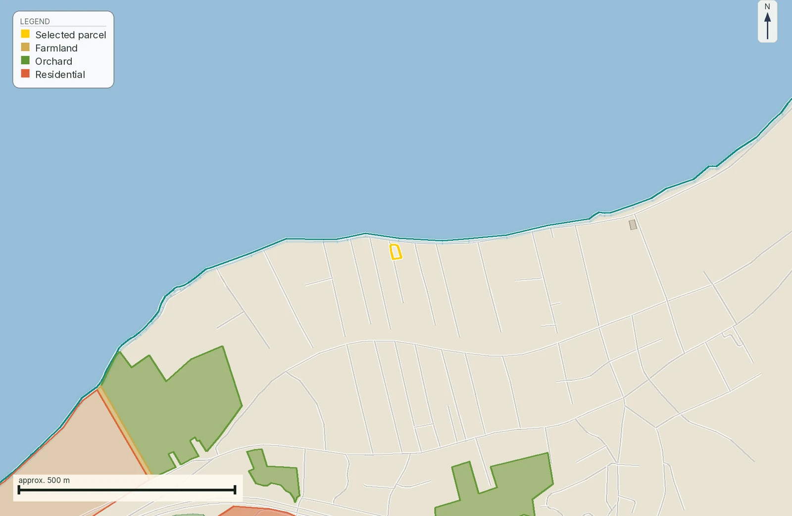
Άγιος Αρσένιος is 1,242 m² of quiet farmland on Naxos. Under one reading it is a settlement plot that can carry 400 m² of house; under the other it is out of plan, 2,758 m² short of the minimum, and carries nothing at all. The difference is a line on a 1988 diagram, and the ΥΔΟΜ is the only office that can say which side of it the plot falls on.
Common questions
What is the difference between εντός σχεδίου and εντός ορίων οικισμού?
An approved ρυμοτομικό σχέδιο draws streets, building lines and blocks, and it comes with a πράξη εφαρμογής that takes land and money from the owners. A delimited settlement of up to 2,000 inhabitants has a boundary and building terms but no street plan and, by default, no contributions. The terms are different too: inside a settlement the 1985 decree caps a dwelling at 240 m² under 700 m² of plot and 400 m² above it, while in plan the figures come from that plan alone.
How much land does the state take when a plot is brought into a plan?
Between 10% and 50%, applied slice by slice. On a 4,000 m² property the calculation under άρθρο 139 παρ. 4 ν. 5306/2026 is 10% of the first 500 m², 20% of the next 500, 30% of the next 1,000 and 40% of the last 2,000, which is 1,250 m² or 31.25%. Where the planning unit falls short of the open space the standards require, περ. στ raises the bands automatically to ceilings of 30/30/40/50, and the same property then loses 1,700 m².
I am buying an in-plan plot. Could there be a debt attached to it?
Yes, and it is the εισφορά σε χρήμα. It is assessed after the πράξη εφαρμογής is ratified and is payable over nine years in 108 monthly instalments, minimum EUR 50 a month, with a 20% discount for paying in full within a year. Άρθρο 141 παρ. 4 ν. 5306/2026 requires a municipal certificate that at least 30% of the total has been paid before the deed can be signed, and the deed must state the balance on pain of nullity. Ask the δήμος for the position on the specific ΚΑΕΚ.
How big a house can I build on 4,000 m² out of plan?
186 m² of total floor area across every storey. Άρθρο 256 παρ. 1 περ. β ν. 5306/2026, which codifies άρθρο 33 παρ. 3δ ν. 4759/2020, gives 186 m² for the first 4,000 m² plus 1.8% of anything between 4,000 and 8,000, then 258 m² plus 0.9% above 8,000, capped at 360 m². The coverage limit of 10% would allow a 400 m² footprint on that plot and the formula never lets you use it.
The seller says the plot is inside the village. How do I check that?
Ask for the delimitation act with its diagram and the ΦΕΚ it was published in, and have the plot plotted against that diagram on a τοπογραφικό. The boundary is an administrative line drawn in the 1980s and it does not follow where houses were later built. Ask a second question as well: whether that settlement has been re-delimited under the 2025 criteria now in άρθρα 226–248 ν. 5306/2026, because the αρτιότητα figures differ between the two regimes.
Is out-of-plan land always worse than a settlement plot?
Not on every criterion. Out of plan costs nothing to enter, carries no contribution and no municipal debt, and a 4,000 m² plot is a 4,000 m² plot. What it costs is size and shape: 186 m² of house, 25 m of frontage on a road that is public in law, and 15 m of setback from every boundary under άρθρο 251 παρ. 4, which a narrow plot cannot satisfy at all. A settlement plot of 700 m² carries more house than four στρέμματα of open country.
What happens if the boundary runs through the middle of my plot?
Each part is judged under its own regime, and the part you intend to build on has to satisfy that regime's area, frontage and setback tests on its own. A plot that is 1,000 m² inside a settlement and 3,000 m² outside it is not a 4,000 m² plot in either category. Whether the αρτιότητα threshold is measured on the whole parcel or on the part is the first thing to put to the ΥΔΟΜ in writing, because the arithmetic and the answer both change.
Does your report tell me which of the three the plot is in?
Section 1.2 places the parcel against the planning layers of the Ενιαίος Ψηφιακός Χάρτης and names the act covering the point, with the date the layer was read, and it says plainly when nothing is published for that ground. What it cannot do is tell you whether a πράξη εφαρμογής has been ratified over an in-plan parcel or what is outstanding on its εισφορά σε χρήμα; those live with the δήμος. The binding statement of the regime is the βεβαίωση όρων δόμησης from the ΥΔΟΜ.
Keep reading
What makes a Greek plot buildable: άρτιο, οικοδομήσιμο and the 4,000 m² rule
Planning terms and land use in Greece: reading όροι δόμησης and checking them yourself
Everything that can stop you building in Greece: the restriction stack
Legal road access in Greece: what πρόσωπο σε κοινόχρηστη οδό means, and how a road becomes public
Check this on your own parcel
Pin the plot, confirm the KAEK, and every check in this guide is read against it and written up with its source and date. EUR 29 total · VAT included.