
Pillar: Ground, hazard and utilities
Διαβάστε το άρθρο στα ελληνικά.
Earthquake risk and Greek property: read the map before the building
On this page
A Greek seismic map can justify a professional question. It cannot rate a house, confirm a foundation or make a purchase safe.
This guide is a preliminary screen for a cost or timing question, not legal, surveying, engineering or tax advice; read the full scope and limits before relying on it.
Have a specific plot in mind? Every check in this guide can be run on it, with source and date, for EUR 29 total · VAT included. Pin it on the map →
Earthquake exposure belongs in the first property conversation in Greece, but it is easy to ask the wrong question. A national or regional hazard layer can tell you that the ground-motion context deserves attention; it cannot tell you that a house is safe, unsafe, or worth a particular repair budget. This page turns the question into a buyer workflow: start with the purchase checklist, identify whether you are buying land or a building, then ask the right professional to connect the map to the actual structure.
Greece has a serious seismic setting, and the state organisation responsible for earthquake planning and protection is OASP. That fact is useful context. It settles nothing about one particular house. OASP publishes earthquake information, regulations, guidance and material about pre-earthquake building checks. The distinction matters because “seismic hazard” describes the possibility and intensity of ground motion, while “risk” also depends on people, buildings, construction quality, occupancy and consequences. A vacant field and a stone house on the same hillside do not carry the same decision.
The useful question before signing is narrower: which layer was read, which building record exists, which fact is absent, and which absence could change the offer? The first report page is a triage note. It stops short of a verdict. It should preserve the legend, publication date, scale, geometry match and uncertainty, then hand a deliberately short brief to the engineer who can inspect the structure or define a site investigation. That is the point at which a buyer stops arguing with a colour and starts commissioning an answer.
What a Greek seismic map actually measures
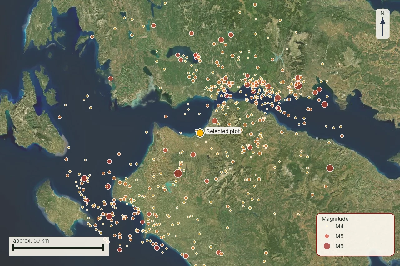
A map can represent a hazard model, a historical event catalogue, a zoning classification, an intensity estimate, an accelerogram station or a planning input. Those are not interchangeable. A bulletin about an earthquake that occurred in 2026 is an event record. A hazard map is a model or classification of expected shaking. A building-screening form is a structured inspection of a building. When an article or listing collapses all three into “the area is safe”, it has removed the information a buyer needs.
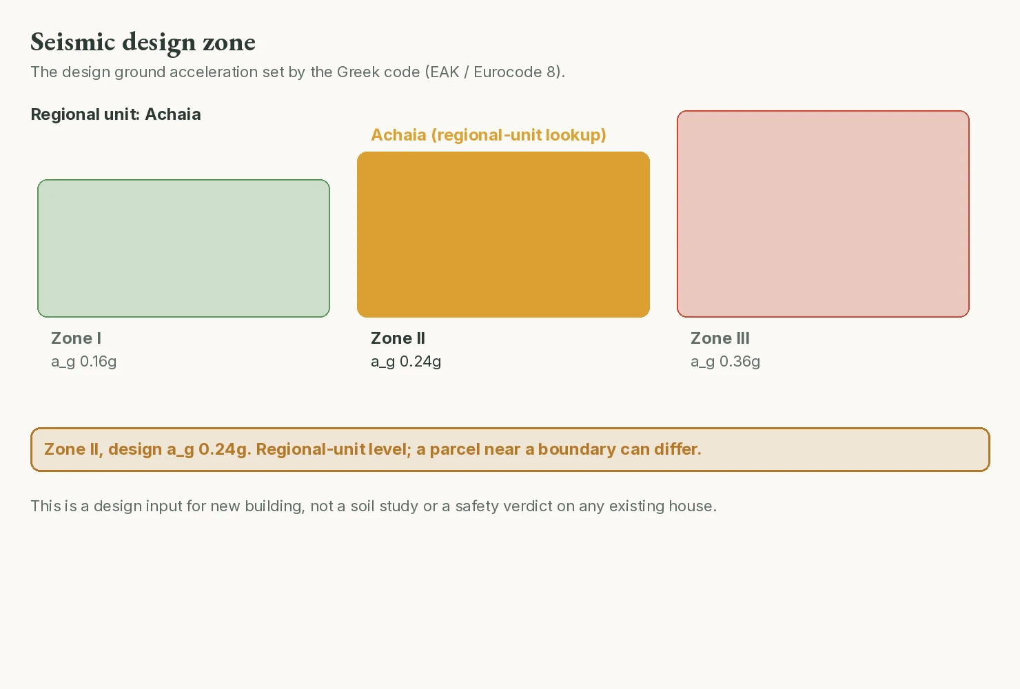
Greece divides itself into three seismic design zones, and the building code assigns every municipality to one of them. That assignment fixes the design ground acceleration a plot’s engineer has to use, but the number itself is not something a buyer reads off a public map: it comes from the ΕΑΚ, the Greek seismic code, applied together with the current Eurocode 8 national annex for that municipality and the relevant soil class. Ask the engineer for that ΕΑΚ/Eurocode 8 check by name. It is the one document that turns “Greece has three zones” into a number for this particular plot.
Read the legend before the colour. Look for the measured or modelled variable, reference period, return period if relevant, resolution, coordinate system and publishing authority. If the map has no legend, source date or method, treat it only as a lead until its method can be checked. The OASP earthquake-bulletin service is valuable for understanding recorded events and official communication; it is not a substitute for the design basis of a house.
For a plot with no building, the map can justify commissioning a geotechnical or engineering conversation. For a completed house, it can justify requesting drawings, permits, construction date, alterations and any previous assessment. The map does not rank two houses simply because one sits in a darker polygon.
Hazard, exposure and risk are different ledgers
Keep four columns in the buyer file. Hazard asks what physical shaking may occur. Exposure asks what people, structures and infrastructure are present. Vulnerability asks how those exposed elements may respond. Consequence asks what disruption or loss would follow. A regional map usually addresses only the first column, and sometimes only a proxy for it. The final property risk runs through all four links. No single number carries it alone.
This distinction changes the order of questions. A rural plot with no structure may have high hazard context but modest present exposure. A masonry house with an unrecorded extension may have a much more urgent vulnerability question. A hillside road or retaining wall can become an access and safety issue even when the main house itself was properly designed. Do not let a low current exposure hide the future design risk of a new build.
LandCheck can record the area-level signal and the evidence gap. It cannot infer reinforcement, ductility, foundation depth, soil profile or construction workmanship from a polygon. Those belong in the engineer’s scope and in the documents the buyer obtains.
Start from property type, then read the colour
The first gate is whether the buyer is purchasing bare land, a permitted new build, an older house, a traditional stone building, an apartment, or a property with visible additions. Each type needs a different evidence pack. A bare plot needs the future project, ground conditions and applicable design rules. An existing house needs the construction file and an inspection of the actual building. An apartment needs the building’s common file too; a neighbourhood-level map alone will not cover the unit’s own alterations.
Ask for the year of construction and every meaningful alteration, but do not treat the seller’s answer as proof. Request the building permit or the file reference, approved drawings, completion documents, any regularisation or electronic building identity material applicable to the property, and evidence of repairs after known events. If documents are unavailable, write “not provided”. Do not write “no issue” when nothing was actually supplied. The absence of a file is itself a decision input.
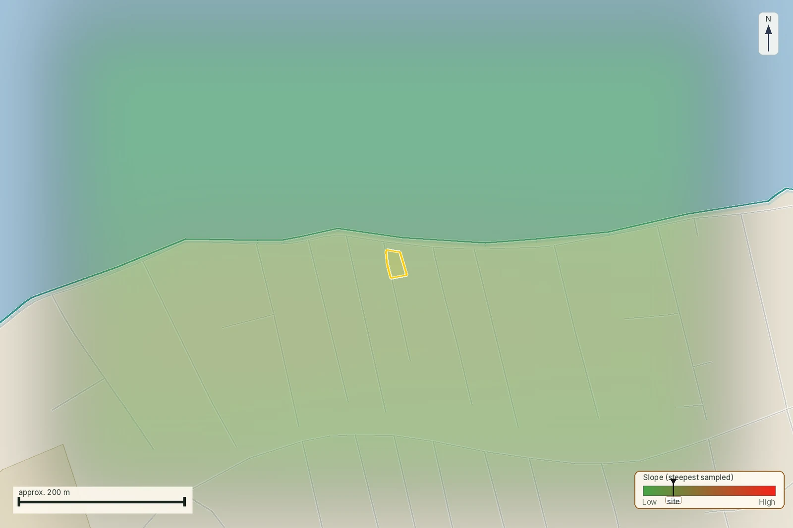
For land, a seismic map should sit next to the topographic diagram, slope evidence and the intended footprint. A buyer proposing a cut-and-fill villa on a steep site has a different question from a buyer preserving an existing low-rise house. The intended use should be written down before the engineer is asked to comment.
Read the OASP event record without misusing it
OASP’s earthquake bulletin service records events and official communications. A recent event near a property can prompt sensible questions: was damage reported, were inspections announced, did a municipality issue information, and does the property file include repairs? It does not prove that the property was damaged or undamaged. The absence of a bulletin entry is not a certificate of absence of shaking, and a magnitude number is not a building condition report.
Event catalogues also need geographic care. A listed epicentre is a point, or an estimated location. It does not run as a line through every nearby parcel. Distance, depth, mechanism, local soil and the building’s response all matter. A screenshot that places a marker on a basemap without explaining the uncertainty can look more precise than the underlying information.
Use event material as a prompt for document retrieval and inspection. If the seller says “the house was repaired after the earthquake”, ask for the engineer’s report, invoices, permits and photographs. If the seller says “nothing happened”, ask how that was established. Both statements are leads until tied to records or a professional inspection.
Site conditions can change the engineering question
A regional hazard classification is not a substitute for site investigation. Soil stiffness, fill, slope geometry, groundwater, rock quality and local topography can change how a site behaves. A broad map can therefore be useful even when it cannot answer the building question: it tells the buyer that the site should not be treated as an anonymous flat surface.
For an existing structure, ask the engineer whether a geotechnical investigation is necessary and what can be learned from the available record. For a new project, ask what level of site information the design requires. Do not turn a generic online soil label into a foundation recommendation. A map can identify a reason to investigate; it cannot choose a foundation system.
Topography matters operationally too. A steep approach road, retaining wall, cut slope or rock excavation may affect construction logistics, emergency access and cost. None of that is a seismic defect by itself. All of it belongs in the property’s exposure record, kept in the same preflight file.
What to request for an existing house
Request a coherent building file. A pile of unrelated photographs will not answer an engineer’s questions. The minimum starting set is the permit or legalisation reference, approved plans, the most recent title and building identity documents available to the seller, records of additions, and any engineer’s assessment or repair recommendation. For an apartment, include the building’s original permit and common structural information when available.
Then compare the paper with the physical building. Look for enclosed balconies, removed walls, added floors, roof changes, heavy tanks, solar equipment, retaining walls and changes to the ground around the foundations. This is not a visual certification; it is a mismatch screen that tells the buyer what to put in front of an engineer.
Ask whether the property was inspected after a known event, but avoid asking only “is it earthquake-proof?”. A professional can answer a defined question more reliably: what is the structural system, what alterations are visible, what records are missing, and is a further assessment warranted before purchase?
| DOCUMENT OR SIGNAL | What it can show | What remains open |
|---|---|---|
| Approved plans | Show the permitted configuration | Do not prove that the built condition matches |
| Repair report | Explains a past intervention | Needs engineer review and scope of works |
| Visual inspection | Finds visible signs to investigate | Cannot see concealed damage or design quality |
| Seismic map | Sets area-level context | Cannot grade the house |
What to request for a vacant plot
A vacant plot has no building to inspect, but it still has a design question. Ask the surveyor and engineer to work from the same boundary, level information and proposed footprint. The evidence file should identify the map source and date, the topographic survey date, any geotechnical information, access constraints and the assumptions behind the proposed project.
Do not ask a seismic map whether you may build. Ask the competent professional what the current planning and structural design framework requires for the intended building, and whether site-specific investigation is needed. The answer may differ for a lightweight small structure, a retaining-heavy hillside project, or a larger building with different occupancy and design demands.
If the seller markets a plot as “ready to build”, keep that statement separate from seismic evidence. Buildability, title, road access and structural design are different gates. A plot can clear one and still fail another, which is why the buildability guide and the slope guide belong in the same buyer sequence.
Decision gates before a deposit
Gate one is identity: do the address, parcel boundary, topographic file and property documents refer to the same place? Gate two is exposure: is there an existing building, a proposed structure, a retaining system or a difficult access route? Gate three is evidence: do the map date, design assumptions and building file allow a professional to form a view?
Pause before the deposit if the seller will not provide the building file, if visible alterations are unexplained, if the map is being used as a building certificate, or if the engineer cannot identify the next document required. A pause is not a prediction of failure. It is a way to avoid paying before the decision-critical uncertainty is named.
Proceed to professional review when the parcel and building identity are coherent, the source trail is dated, and the contract can make the necessary evidence a written condition. The condition should name the document or professional conclusion, the date, and the consequence if it is not obtained. A vague phrase such as “subject to being safe” gives no one a testable gate.
How LandCheck should phrase the result
A useful report conclusion is specific and modest: “The selected location sits in a Greek seismic context that warrants professional review. The public evidence does not contain a property-level structural assessment. The building file and site-specific questions below are missing.” That sentence gives the buyer an action without pretending that a map has inspected the building.
A weak conclusion would say “high seismic risk, avoid” solely because a polygon is dark. Another weak conclusion would say “low seismic risk, safe to buy” because no event is visible. Both turn incomplete evidence into advice. The right output can be more valuable: it names the uncertainty, the professional, the document and the point in the purchase workflow where the answer is needed.
Keep confidence attached to the claim. Confidence can be high that OASP publishes the cited material; medium that the selected coordinate falls within the relevant mapped context; and low that the existing building behaves in any particular way. That is what honest evidence design looks like: a decision about where the confidence sits, made in the open.
What the map does not confirm
The map does not confirm that an existing building complies with the seismic code in force when it was designed, that later alterations are legal, that foundations are adequate, that masonry or concrete is undamaged, that a retaining wall is stable, or that a future project can be designed without additional investigation. It also does not prove that a reported earthquake affected this parcel or that an unreported event did not.
It does not confirm ownership, title, encumbrances, road rights, buildability, insurance cover, repair cost, resale value or a safe purchase decision. It does not convert a seller’s “earthquake-proof” phrase into an engineering opinion. It does not replace the controlling file held by the authority or the inspection carried out by the professional.
Where the source is unavailable, the report must say so. “No map result” is not the same as “no seismic hazard”. “No visible damage” is not the same as “no damage”. The missing-data language is part of the evidence. It is not a footnote.
Missing-data checklist for the buyer
- Exact parcel boundary, survey date and coordinate reference.
- Property type and intended use written in one sentence.
- Building permit, approved plans and construction year, if a building exists.
- Records of additions, regularisations, repairs or post-earthquake inspections.
- Topographic survey, slope information and any geotechnical report.
- Engineer’s written view on whether a further seismic or structural assessment is needed.
- Contract wording that identifies the required document before the deposit.
- Fresh source check immediately before signing if the file or project has changed.
Questions for the lawyer and engineer
- Lawyer: which documents must be made a condition of the offer or pre-contract?
- Lawyer: do the title, plans and declared building configuration describe the same property?
- Engineer: what structural system and alteration history can be established from the file?
- Engineer: is a site investigation or structural assessment proportionate to the intended use?
- Engineer: are retaining walls, cut slopes, tanks or heavy additions part of the inspection scope?
- Engineer: what conclusion can be given in writing, and what remains outside the inspection?
- Both: which missing answer could change the price, timing or decision to proceed?
- Buyer: when must the source and professional conclusion be refreshed?
Buyer workflow from listing to decision
Before the viewing: save the listing, identify the property type, obtain the address or parcel information, and read the OASP material without assigning a building score. At the viewing: photograph only what you have permission to record, note visible alterations, retaining structures and cracks, and do not diagnose them. Before an offer: request the core building or site file, compare the same boundary across documents, and commission the right professional.
Before a deposit: write the decision gate into the legal process itself. An informal message will not hold it. The gate should identify the required file or opinion and what happens if it is missing or adverse. Before the deed: refresh the records if the project, ownership, building condition or source dates changed. This sequence prevents an area-level map from doing work reserved for a structural inspection.
The final question to put to the file is “have I moved the decision-critical uncertainty to the person and document that can answer it?”. A map that simply looks convincing has not answered that question. If the answer is no, pause. The report has done its job by showing where the unknown sits.
| DECISION FILE | What it can show | What remains open |
|---|---|---|
| Public context | OASP source, date and map meaning | Area-level only |
| Property evidence | Plans, permits and alteration record | Must match the building |
| Professional view | Defined inspection question and scope | Not replaced by a screenshot |
| Contract gate | Named document and consequence | Drafted by the buyer’s lawyer |
A buyer should also separate urgency from severity. A missing building file may be an urgent request even when no map suggests exceptional hazard. Conversely, a complete-looking file may still justify a site inspection when the proposed work changes the ground or adds weight. The report should record both axes: how important the answer is to the decision, and how much confidence the current evidence deserves.
Do not outsource the sequence to the seller’s preferred professional. The buyer can ask for a neutral engineer, give that engineer the complete source register, and request a written scope before paying for a larger study. The relevant question is not whether someone can produce a reassuring sentence; it is whether the sentence answers the defined building or site question and identifies its assumptions.
For remote buyers, this written trail is especially important. A translation can explain OASP terminology, but it cannot replace the Greek file, the engineer’s inspection or the lawyer’s contract wording. Keep the original document, the translated explanation and the date of every call together. If the seller later supplies a different plan, the mismatch should stay visible. It should never be silently absorbed into the report.
The most useful result may therefore be a pause with a short list: one document to obtain, one professional to instruct, one physical feature to inspect and one contract condition to draft. That is a stronger preflight outcome than a decorative hazard score, because it survives the handoff from buyer to local expert.
Common questions
Does a seismic zone tell me whether the house is safe?
No. It is area-level context. A civil engineer must review the building, its documents, its alterations and any site-specific question.
Is a recent OASP earthquake bulletin proof that this parcel was damaged?
No. It is an event record, and a reason to ask for local records or an inspection. It does not certify damage at parcel level.
What should I request for an older Greek house?
Request the permit, approved plans, construction year, alteration records, available building identity documents and any engineer’s repair or assessment file.
Does a vacant plot need an earthquake assessment?
It may need site and design advice. The required level depends on the intended building, ground conditions and the engineer’s scope; the map alone cannot answer it.
Can I compare two properties by their map colours?
Only as a first location-level comparison, never as a comparison of building safety, repair cost or purchase value.
What does a missing seismic layer mean?
It means the source was not available or not suitable for the check. It does not mean that seismic hazard is absent.
Should seismic evidence be a condition of the deposit?
If it is decision-critical, ask your lawyer to draft a precise condition naming the document or professional conclusion and the consequence if it is not obtained.
Who can give the property-level answer?
A qualified civil engineer with the relevant file and scope. LandCheck organises the questions; it does not provide the engineering certification.
Keep reading
Buying land in Greece: the pre-purchase checklist, in the order the payments fall
Building on a slope in Greece: read the terrain before the view
What makes a Greek plot buildable: άρτιο, οικοδομήσιμο and the 4,000 m² rule
How to read a τοπογραφικό διάγραμμα: the survey sheet, callout by callout
Check this on your own parcel
Pin the plot, confirm the KAEK, and every check in this guide is read against it and written up with its source and date. EUR 29 total · VAT included.