
Pillar: Ground, hazard and utilities
Διαβάστε το άρθρο στα ελληνικά.
Building on a slope in Greece: read the terrain before the view
On this page
A Lefkada parcel with a 28.6% mean slope and a track 10 m away, compared with a Trikeri parcel at 19.6% and a flat Naxos control at 2.7%, to identify what the engineer must resolve before a deposit, with the view treated as a design preference.
This guide is a preliminary screen for a cost or timing question, not legal, surveying, engineering or tax advice; read the full scope and limits before relying on it.
Have a specific plot in mind? Every check in this guide can be run on it, with source and date, for EUR 29 total · VAT included. Pin it on the map →
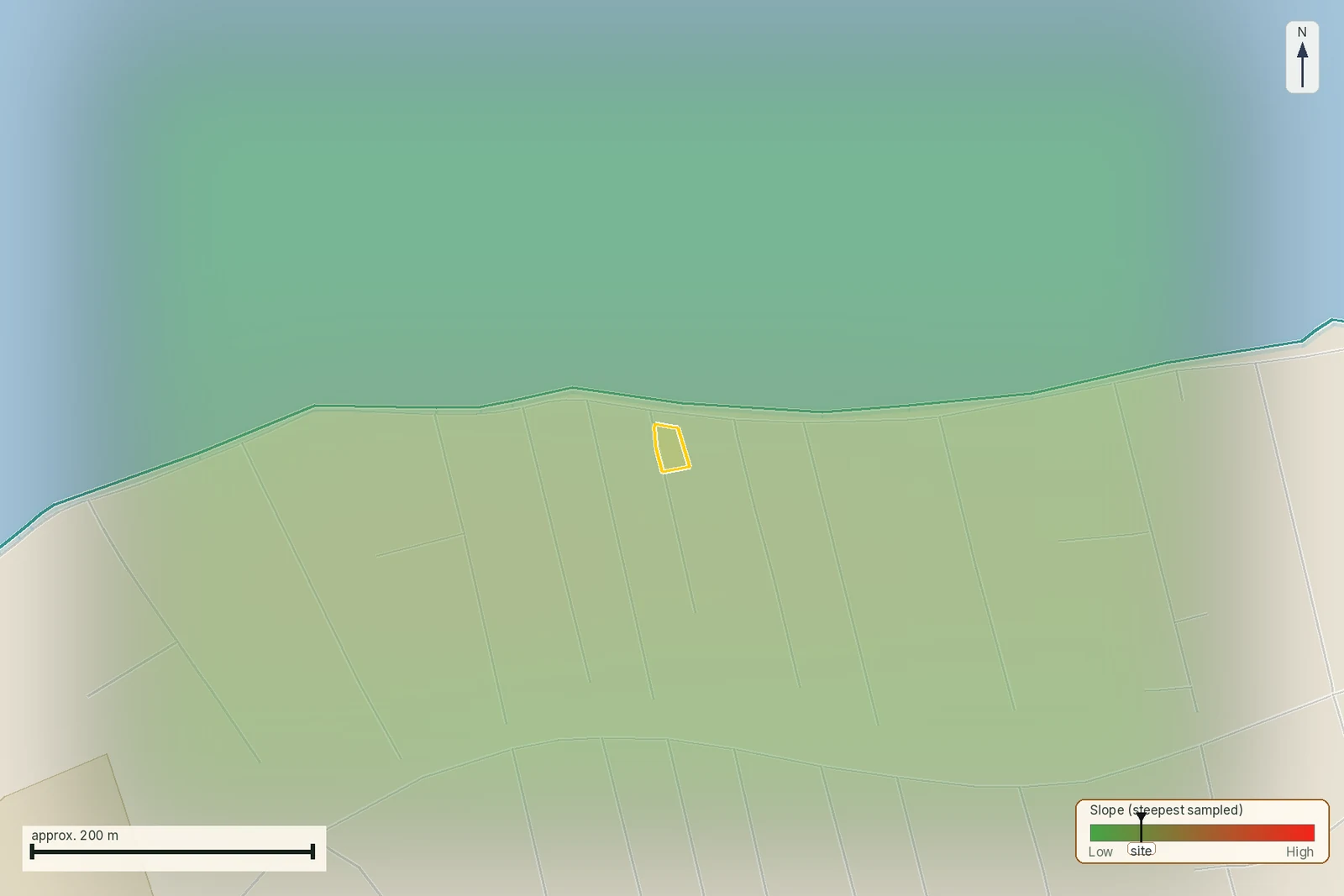
The parcel in Poros, Lefkada, is 41,307 m² with a mean slope of 28.6%. The nearest mapped road is only 10 m away, but it is a track, so the distance does not create legal frontage. A second steep comparison, in Trikeri, runs at 19.6%. A flat control in Agios Arsenios, at 2.7%, completes the set. The useful buyer question concerns what the terrain, access and building file require before a deposit, with the view treated as a design preference.
Read this beside the guide to legal road frontage and the guide to buildability and derogations. A slope check tells you about the physical project. The other two guides deal with the legal road and planning gates that a contour map cannot settle.
The parcel starts with a terrain number
The parcel record shows KAEK 340340402033 in Poros, Lefkada, at 41,307 m² and a mean slope of 28.6%. “Mean” matters. It is an average over the parcel and cannot describe every proposed building pad, driveway turn or wastewater route. A design can sit on a gentler part, a steeper part or a place where cutting the ground changes the answer. The first request is a contour-aware survey tied to the parcel boundary.
The number also does not describe soil, rock, drainage or the condition of the track. Those are separate site questions. Keep the 28.6% as a dated screening fact and hand the next question to an engineer.
What 28.6% means for a buyer
A slope changes the geometry of a project. It can affect where a level floor might sit, how access reaches the building, how rainwater moves, and whether the proposed works need excavation, retaining or a different foundation strategy. The research establishes the slope figure and the need to examine construction cost; it does not supply a design, a retaining-wall quantity or a price for this parcel.
That limit is useful. A buyer can ask for a written comparison of two or three possible building positions, with the cut and fill, retaining, drainage, access and utility implications stated for each. “The plot is buildable” is too short to tell you which part of the hill the sentence refers to.
| Observation | What it tells the buyer | What an engineer must still examine |
|---|---|---|
| Mean slope 28.6% | The parcel is a steep-terrain screening case. | Local slope at the footprint, contours, ground and foundation strategy. |
| Nearest road 10 m | The mapped network is close. | Legal frontage, access right, width, grade and vehicle route. |
| 41,307 m² area | The parcel is above the general 4,000 m² area baseline described in the source. | Recognised road, special rules, terms and written ΥΔΟΜ answer. |
| Sea view | The site may have a valuable outlook. | Whether any permitted footprint can reach it without unacceptable works. |
Trikeri shows that “steep” is a range
The Trikeri parcel has a mean slope of 19.6% and an elevation of 287 m in its own record. It is materially less steep than the Poros parcel, yet it is still a terrain question for the design team. The comparison is not a national threshold. It gives the buyer a second point: terrain cost does not begin at one magic percentage and disappear below it.
Ask the engineer to use the same method for both parcels. If one report gives a mean and another gives a maximum, they are not directly comparable. Request the source surface, the parcel mask, the units and the location of the intended footprint. A neat number without its measurement method can create false precision.
Agios Arsenios is the flat control
The Agios Arsenios parcel on Naxos records a mean slope of 2.7%. It serves as a control for the physical question, while its planning and title files remain separate. When a buyer sees the Poros parcel’s 28.6% and the Naxos parcel’s 2.7% in the same method, “terrain difficulty” has a reference point. It still does not answer the planning, road, forest or title files.
Controls are especially valuable in a report because they stop a risk label becoming a mood. The Naxos parcel does not prove that every flat parcel is easy. The Poros parcel does not prove that every part of its boundary has the same grade. The numbers tell the engineer where to inspect with greater care.
Area does not create a building right
The corrected out-of-plan material gives a general baseline of 4,000 m² together with 25 m of frontage on a common road, subject to special local provisions. The parcel’s 41,307 m² clears the area number. Its 10 m distance to a mapped track does not establish the frontage condition. The two facts must not be merged.
The same source gives the derogation route for smaller historic plots, with area, depth, frontage and creation-date conditions, and the current filing date of 30 June 2027 in article 273 of Law 5306/2026 as amended by article 133 of Law 5317/2026. This parcel is above the ordinary area baseline, so the buyer should ask for the ordinary rule and the local planning terms, while leaving the derogation table to the smaller historic cases it describes.
The track is close, but the access file is not closed
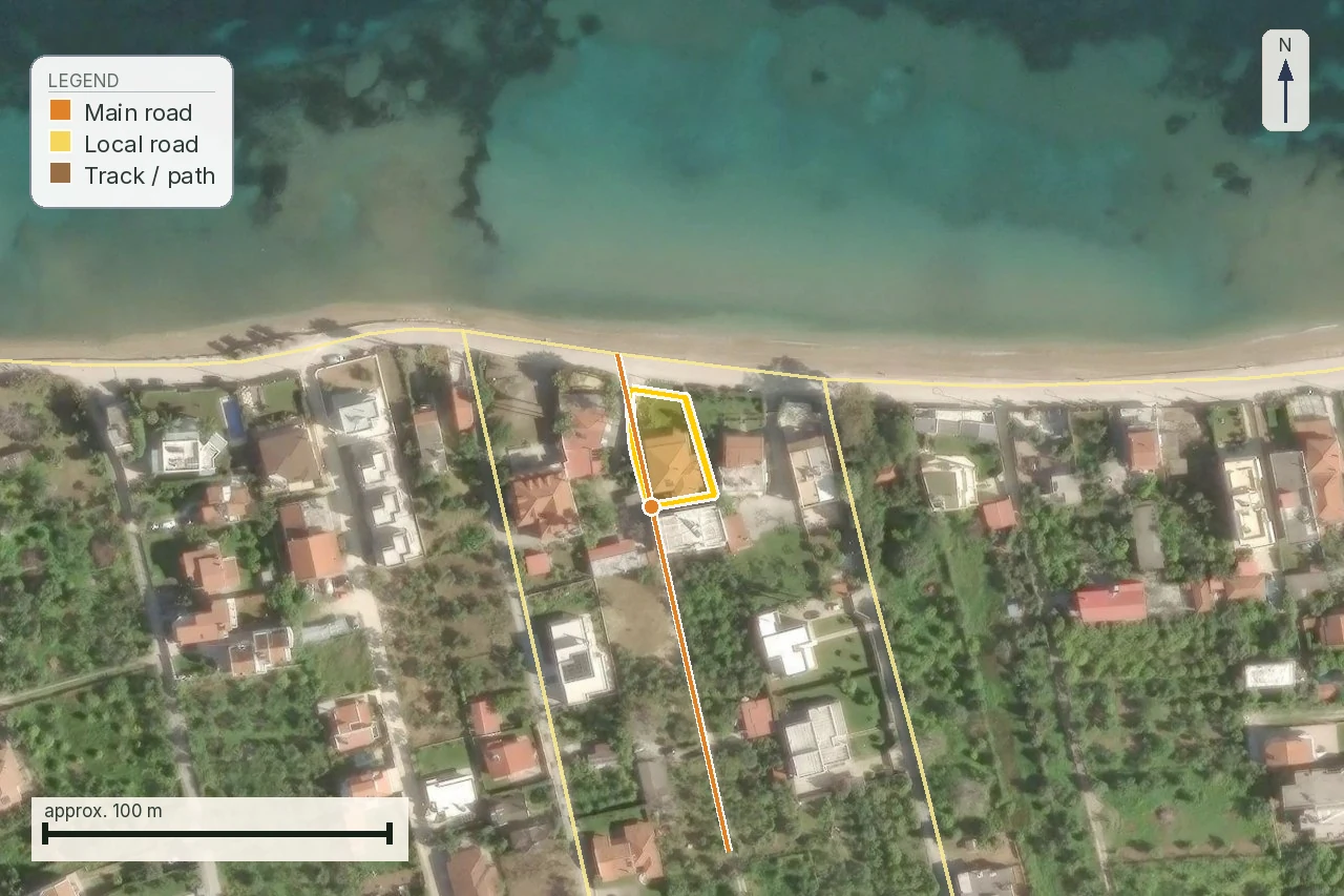
The parcel record’s nearest-road entry is 10 m and class `track`. That is a mapped observation about distance and classification. It does not say that the track is a recognised common road, that this parcel has a right to use it, that it reaches the boundary, or that an emergency or construction vehicle can follow it.
Ask for the legal access document, the road class and the point where the route meets the parcel. Then ask the engineer to show the gradient, turning space and construction route on the topographic drawing. A driveway that is physically possible can still need a separate legal answer.
General terms still need the local rule
Article 251 of Law 5306/2026, Gazette A 88/8 June 2026, describes general out-of-plan terms: maximum floor-area ratio 0.18, coverage 10% and two storeys in paragraph 2, with the reservation that special provisions can apply. The same planning material records a general height of 7.50 m measured from the surrounding ground. These are reference terms; the written answer for this parcel may apply a different local route.
The planning service read for the parcel on 1 August 2026 returned no planning polygon in the research table. That result means the service did not supply a planning polygon for the parcel in that read. It does not mean there is no planning rule, no local act or no document that ΥΔΟΜ must examine.
For a sloping parcel, “height from surrounding ground” also needs a drawing. Ask how the engineer and ΥΔΟΜ apply the term across the proposed levels. A number read from the upper edge of a section may describe a different building than the same number read from the lower edge. Keep the written term beside the section that uses it.
The building envelope follows the hill
On flat paper, a rectangle looks like a building envelope. On this parcel, the engineer must place that envelope against contours, access and the ground profile. The legal terms set ceilings and distances. The terrain determines whether the proposed shape can be reached and constructed within them.
Ask for sections through the intended footprint, the access line and the wastewater route. Ask which level is used to describe the surrounding ground. Ask where excavation stops and where retaining is proposed. If the answer is “the view is on the upper side”, request the drawing that connects the view to a lawful and buildable footprint.
One drawing is rarely enough for a hillside purchase. The plan view can show the parcel and the proposed house while hiding the height difference between the road and the pad. A longitudinal section exposes that difference. A cross-section shows whether the footprint is cut into the slope or sits on fill. Ask for both, with the parcel boundary and the proposed finished levels marked.
The engineer should also state what has not been measured. If the ground profile comes from a coarse model, if the track was not walked, or if the wastewater route is only conceptual, those are missing-data items. They belong in the offer file before a seller’s word “buildable” is allowed to carry a price.
Cut, fill, retaining and drainage belong in the first estimate
On a slope, the cost question is often a chain. Cut changes the ground. Fill changes levels. Retaining holds a new edge. Drainage manages water around the works. Access and utility trenches follow their own grades. This is a request for a site assessment, not a claim that this parcel needs a particular wall or system.
Before the deposit, ask for a preliminary scheme that names these works and states which are included in the price. If the seller’s figure covers only the house, a view can hide the civil works outside its footprint. The report should carry the unknowns forward until the engineer has measured them.
| Engineer’s drawing | Question to answer | Buyer’s document |
|---|---|---|
| Longitudinal access section | Can vehicles and construction deliveries reach the pad at the proposed grade? | Topographic plan and access evidence. |
| Cross-section through the pad | Where are cut, fill, retaining and boundary distances? | Sections tied to the KAEK polygon. |
| Water route | Where does runoff travel, and where do wastewater works sit? | Drainage and wastewater concept. |
| Planning overlay | Which general or special term governs the footprint? | Written ΥΔΟΜ answer and source act. |
A sea view is an outlook, not a permit
The parcel’s setting can make the sales description persuasive. The physical prospect of a sea view says nothing by itself about road frontage, forest status, planning terms, boundary distances, wastewater, excavation or the final position of a building. A view can be visible from land where the lawful footprint is smaller, lower, differently oriented or not yet established.
Use the view as a design preference after the risk file is clear. Ask the engineer to mark the view direction on a drawing that also shows the permitted envelope and the access route. If the two cannot be shown together, the buyer has a design aspiration and an open buildability question.
This is also where a small marketing phrase can conceal a large design change. A house moved a few metres to reach the outlook may cross a contour, a boundary distance or the most difficult part of the access line. Ask for the alternative position that protects the terms, then compare its view, works and cost openly.
The parcel’s separate forest result does not settle the slope
The parcel record shows an ΑΑ forest-map result marked as verified at source. That is a useful separate observation. It does not turn the slope into a flat site, make the track frontage, or supply the planning polygon missing from the 1 August planning-service read. A clean answer in one register does not clear the others.
This is the discipline a parcel report needs. Carry the forest code, terrain metric, road class and planning read in separate rows. Let the engineer, ΥΔΟΜ and lawyer answer their own row. The buyer then sees which problem is solved and which problem is merely waiting.
The finding read on 1 August 2026
On 1 August 2026, the Hellenic Cadastre parcel record for Poros, Lefkada was read with the planning-service table. It established the screening facts used here: KAEK 340340402033, 41,307 m², mean slope 28.6%, nearest road 10 m classified as a track, and no planning polygon returned in that read. The same read gives Trikeri at 19.6% and Agios Arsenios at 2.7% for comparison. The meaning is a purchase sequence: obtain the contour-based engineering file, establish access and frontage separately, and ask ΥΔΟΜ for the written terms before treating “buildable” as anything more than an offer description.
Questions for the engineer before money moves
- What is the slope at the proposed footprint? How does it compare with the parcel mean?
- Which contours and levels support the sections?
- Where do cut, fill, retaining and drainage works begin and end?
- Can construction vehicles reach the footprint on the mapped track, and under what right?
- Which wastewater route works with the terrain?
- Which building terms and boundary distances did ΥΔΟΜ confirm in writing?
- Does the proposed sea-facing position remain inside the documented envelope?
Ask for the answers in the same units and against the same KAEK. A verbal tour can be useful for choosing a site visit, but it cannot preserve which boundary, level or road segment the answer concerned. Put the engineer’s drawing, the written ΥΔΟΜ response and the access documents beside the report’s dated screening row.
What the map does not confirm
A mean slope does not confirm the slope at a foundation, a retaining design, a drainage solution, a construction cost or a permit. Ten metres to a track does not confirm frontage, a right of way or vehicle access. A missing planning polygon does not confirm that no rule exists. The parcel’s area does not confirm buildability, and a sea view does not confirm a lawful footprint.
Scope of this page
This is a property preflight, not a geotechnical report, topographic survey, structural design, planning certificate, road-right opinion or proof of buildability. It uses the parcel’s dated screening metrics to tell the buyer what to request before a deposit. Have an independent engineer and the ΥΔΟΜ read the same boundary, contours, access route and proposed project; have a lawyer check the rights and documents that the map cannot establish.
Common questions
What does the parcel’s 28.6% mean slope mean for a house design?
It is the parcel’s recorded mean slope, not the grade at every possible footprint. Ask an engineer for contour sections and a comparison of access, cut, fill, retaining, drainage and foundation implications.
Is 28.6% a legal Greek building limit?
The allowed research gives the parcel’s slope as a terrain metric and does not establish a general building prohibition at that number. Buildability still depends on planning, access, ground and the written professional file.
Does a road 10 metres away give the parcel frontage?
No. The parcel record shows a mapped track at 10 m. Distance and road class do not establish a recognised common road, a boundary frontage or a legal right of way.
Why compare the Poros parcel with Trikeri and Agios Arsenios?
Trikeri supplies a second documented mean slope at 19.6%, while Agios Arsenios supplies a flatter control at 2.7%. The comparison gives scale for the terrain conversation, not a legal threshold.
What should a slope estimate include before I make an offer?
Ask the engineer to name access grade, cut and fill, retaining, drainage, foundation approach, utility routes and construction delivery constraints. The research establishes no price for those works.
Does a sea view show that the plot is buildable?
No. An outlook says nothing about the lawful footprint, road frontage, planning terms, wastewater, forest result, boundary distances or construction works needed to reach it.
What did the planning service say about this parcel?
The 1 August 2026 research table returned no planning polygon in that read. It does not mean that no local rule exists. Ask ΥΔΟΜ for the written terms.
Does the parcel’s 41,307 m² area solve the out-of-plan test?
It is above the general 4,000 m² area baseline in the research, but the corrected rule also requires recognised common-road frontage, subject to special provisions. The nearby track does not prove that condition.
What was established about the parcel on 1 August 2026?
The parcel record gave KAEK 340340402033, 41,307 m², 28.6% mean slope, a 10 m track distance and no planning polygon in that read. Those are screening facts, not a buildability certificate.
Keep reading
Legal road access in Greece: what πρόσωπο σε κοινόχρηστη οδό means, and how a road becomes public
What makes a Greek plot buildable: άρτιο, οικοδομήσιμο and the 4,000 m² rule
Planning terms and land use in Greece: reading όροι δόμησης and checking them yourself
Septic tank or sewer in Greece: the wastewater question before buying
Can You Put a Prefab or Tiny House on Land in Greece?
Check this on your own parcel
Pin the plot, confirm the KAEK, and every check in this guide is read against it and written up with its source and date. EUR 29 total · VAT included.