
Διαβάστε το άρθρο στα ελληνικά.
Natura 2000 and Greek property: a confirmed finding, not a flag
On this page
A real Greek parcel sits 1,848 metres inside a Natura 2000 bird reserve on farmland. Five more, tested the same way, sit outside theirs, one by only 127 metres. See what actually changes and what does not.
This guide is a preliminary screen for a purchase or permit question, not legal, surveying, engineering or tax advice; read the full scope and limits before relying on it.
Have a specific plot in mind? Every check in this guide can be run on it, with source and date, for EUR 29 total · VAT included. Pin it on the map →
The parcel at Τερψιθέα, Larissa, KAEK 311500507001, sits 1,848 metres inside Natura 2000 site GR1420011, a 956 km² zone across the Thessalian plain designated as a Special Protection Area for birds. That is not a marginal call, and it changes what this page has to do: instead of explaining how to chase down an unverified flag, it explains what a confirmed Natura result actually does and does not do to a 5.7-hectare farmed plot. Start with the guide to Greek building restrictions and the guide to land use and building terms for the planning questions a Natura result does not answer on its own.
Five other parcels tested the same way, on the same day, sit outside their nearest site: from 127 metres at a plot on Λευκάδα to nearly sixteen kilometres at a plot on the Χαλκιδική coast. The 127-metre result is where the real uncertainty lives, and it is where a buyer's money is better spent on a professional read than on either of this page's two headline numbers.
Inside the site, and what it actually means
The site itself answers the first thing a buyer assumes wrongly. GR1420011 covers 956 km² of the Thessalian plain, and its independently published area, 95,905.36 hectares, agrees with our measured figure to within a third of one percent. Its management body is the Μονάδα Διαχείρισης Κάρλας, Μαυροβουνίου και Κεφαλόβρυσου Βελεστίνου, the joint management unit for the wider Karla, Mavrovouni and Kefalovryso Velestinou area. A zone that size, that close to a working town, is not a wilderness reserve. It is a Special Protection Area classified for its bird populations, with no mapped habitat type and no recorded significant flora attached to the designation. Sitting inside it says something specific about birds. It says nothing general about the land itself.
The parcel's own facts stay concrete regardless: 56,923 m² (5.7 ha) of Thessalian farmland, recorded at KAEK 311500507001. Nothing about standing on that ground signals a protected area, and that is exactly the point of measuring it instead of guessing from appearance.
The near miss at Πόρος, and why 127 metres is not the same as 1,848
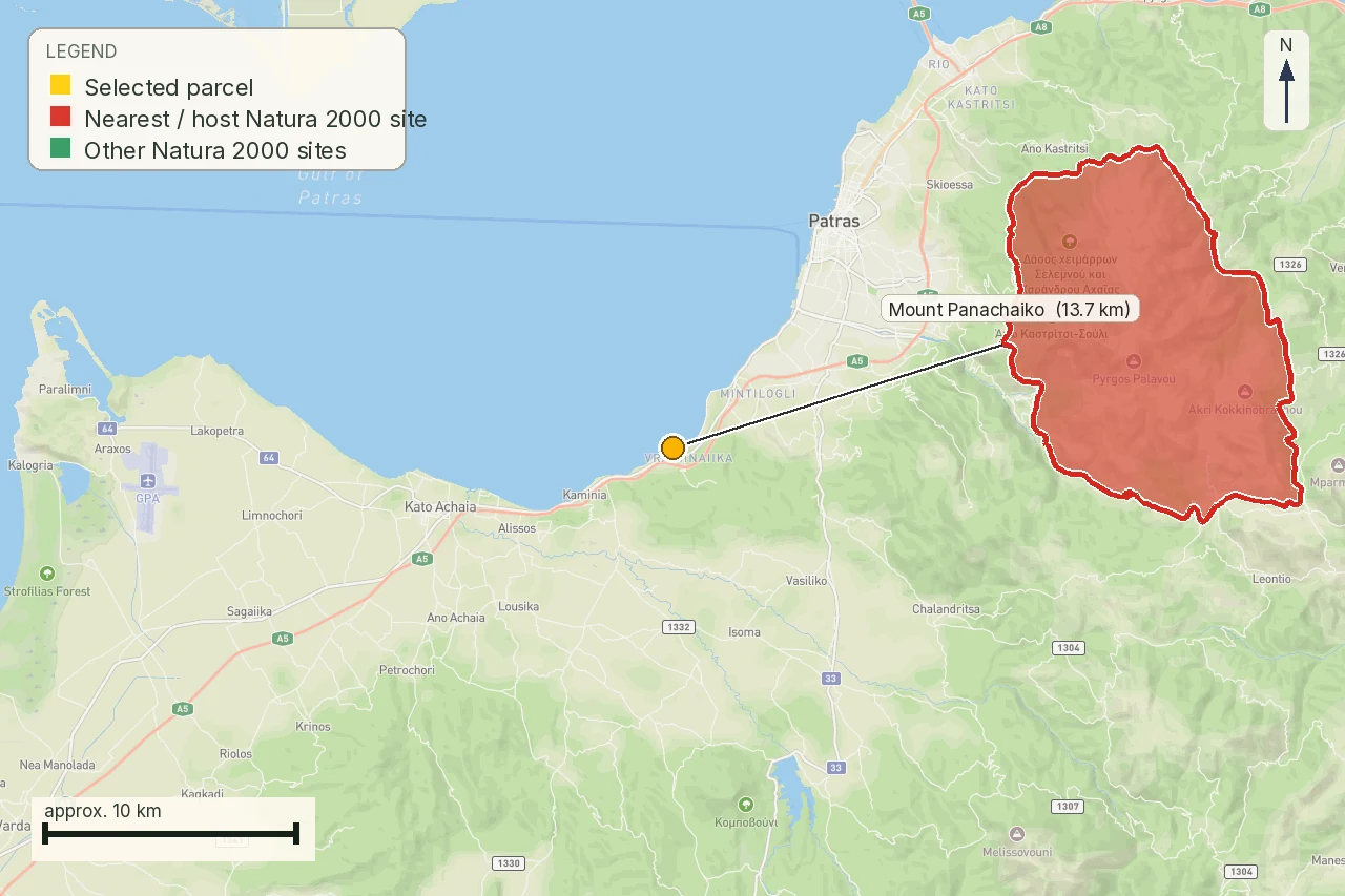
A parcel at Πόρος, Λευκάδα, KAEK 340340402033, sits 127 metres from the boundary of GR2220003, «ΕΣΩΤΕΡΙΚΟ ΑΡΧΙΠΕΛΑΓΟΣ ΙΟΝΙΟΥ», a Special Area of Conservation under the Habitats Directive. Outside, on this measurement. But the test used the parcel's recorded centroid instead of its full outline, and at 1,848 metres that limitation changes nothing: no plausible geometry difference moves an answer that large. At 127 metres it very well might. A boundary revision, a full-outline test instead of a single point, or a difference between the EEA dataset and the Greek State's own published line could each flip this one from outside to inside.
That difference is the most useful sentence on this page. A buyer looking at a Larissa parcel 1,848 metres inside a site does not need a second opinion on whether it is inside. A buyer looking at a plot 127 metres from a boundary needs a licensed surveyor to run the actual outline against the Greek State's own instrument before anyone prices the risk.
Two directives, two different obligations
Greece's Natura 2000 sites carry two different European labels, and which one a parcel meets changes what attaches to it. A Ζώνη Ειδικής Προστασίας (ΖΕΠ), a Special Protection Area, is designated under the EU Birds Directive for its bird populations. A Ειδική Ζώνη Διατήρησης (ΕΖΔ), a Special Area of Conservation, is designated under the EU Habitats Directive for its habitats and species. The Larissa parcel meets a ΖΕΠ. The Λευκάδα plot sits near an ΕΖΔ. A parcel near Τρίκερι, Μαγνησία, meets a ΖΕΠ. Two Naxos parcels sit near the same ΕΖΔ. A plot at Νέα Προποντίδα, Χαλκιδική, has one site nearby that carries both designations at once.
The practical consequence is that "which directive" is not a footnote. A ΖΕΠ obligation is framed around bird conservation objectives; an ΕΖΔ obligation is framed around habitat and species conservation objectives. Both feed the same licensing test in άρθρο 10 ν. 4014/2011, but the objectives a project has to be measured against are the ones that belong to the specific site, not a generic "Natura" standard.
What the licensing route actually asks for
Άρθρο 10 ν. 4014/2011 (ΦΕΚ Α΄ 209) is the operative Natura licensing article. Ν. 5037/2023 (ΦΕΚ Α΄ 78/28.3.2023) is the evidence that it is still current: it refers to a project already approved «σύμφωνα με την παρ. 4 του άρθρου 10 του ν. 4014/2011», treating that paragraph as live law as recently as 2023. Παρ. 1 sends licensing first to the site's own protection decree or ministerial decision where one exists. Only where none exists does the fallback in παρ. 1 apply: a category B project files a stand-alone Ειδική Οικολογική Αξιολόγηση, and a category A project carries the same assessment inside its Μελέτη Περιβαλλοντικών Επιπτώσεων.
Παρ. 2 sets the actual test: the competent authority may agree to a project only once satisfied it will not undermine the site's ecological integrity, and the decision has to focus on, and stay limited to, that site's own conservation objectives. For a ΖΕΠ like the one at Larissa, those objectives are about the bird populations the site was designated to protect. A project review that never mentions birds has not applied the right test.
Category A and category B: two files, one integrity test
Άρθρο 11 παρ. 8 ν. 4014/2011 covers category B: the Ειδική Οικολογική Αξιολόγηση is filed on its own, with the Περιφέρεια, addressed to the site's conservation objectives. Παρ. 9 covers category A: the same assessment sits inside the Μελέτη Περιβαλλοντικών Επιπτώσεων, and the law itself points at παρ. 6 άρθρο 9 ν. 3937/2011, the national Natura site list, for the protected objects the assessment has to name. Παρ. 10 adds the substantive test behind both routes, a δέουσα εκτίμηση επιπτώσεων measured against the habitat, flora, fauna and bird annexes fixed by two joint ministerial decisions, ΚΥΑ ΗΠ/14849/853/Ε103/2008 and ΚΥΑ ΗΠ/37338/1807/Ε103/2010. None of that classifies a single dwelling as category A or B; the category is attached to the actual project instead of the parcel.
Who keeps the file: ΟΦΥΠΕΚΑ, the Περιφέρεια and the site's own managers
Ο ΟΦΥΠΕΚΑ, the Οργανισμός Φυσικού Περιβάλλοντος και Κλιματικής Αλλαγής, was established as a free-standing body by ν. 4685/2020, Κεφάλαιο Γ΄ (άρθρα 26–29). The Natura framework law itself was never amended to create it. Ν. 5037/2023 άρθρο 186 later added the register: it keeps the database of Ειδικές Οικολογικές Αξιολογήσεις filed under άρθρο 11 ν. 4014/2011. Filing a category B assessment, though, goes to the Περιφέρεια under άρθρο 11 παρ. 8, not to ΟΦΥΠΕΚΑ directly. For the Larissa site specifically, the day-to-day management authority is the Μονάδα Διαχείρισης Κάρλας, Μαυροβουνίου και Κεφαλόβρυσου Βελεστίνου, the body that runs the site's conservation programme and the one most likely to have a working answer about this exact parcel.
One correction matters here: the categories that decide whether an area counts as protected in the first place no longer sit inside ν. 3937/2011 at all. They moved to ν. 1650/1986 άρθρο 19, as replaced by ν. 4685/2020 άρθρο 46. Ν. 3937/2011 άρθρο 9 is still the right citation for the Natura-specific rules that follow from being on the list; it is not the source of the categories themselves.
The number that actually changes: minimum plot size inside a site
Άρθρο 9 παρ. 2 περ. α΄ ν. 3937/2011 (ΦΕΚ Α΄ 60/31.3.2011) is the concrete rule a Natura designation adds to a building file. Outside approved town plans, outside settlement boundaries lawfully predating 1923, and outside settlements of up to 2,000 residents, land inside a ΕΖΔ or a ΖΕΠ carries a minimum plot size for building of 10,000 m², well above the smaller thresholds that apply to ordinary out-of-plan land elsewhere. An exception in the same paragraph preserves plots of at least 4,000 m² that were already buildable under the planning rules in force when this provision was published. Περ. γ΄ of the same paragraph preserves any stricter local planning rule that already applied.
The Larissa parcel is 56,923 m², more than five and a half times the 10,000 m² floor. Whichever general out-of-plan default would otherwise have applied to it, the higher Natura threshold does not become the obstacle here. What still has to be confirmed separately, through the planning file, is whether the parcel actually sits outside a plan and outside a qualifying settlement boundary in the first place, since that is the condition that switches this specific rule on.
The blanket rules that apply regardless of the project
Άρθρο 9 παρ. 1 ν. 3937/2011 lists activities that Natura designation blocks outright, network-wide, without reference to any specific site's own act: hazardous industrial installations covered by the Seveso framework, other high-nuisance industrial installations, trawl-net or dredge fishing over coral and calcareous seabeds, fish farming over Posidonia meadows, and roadside advertising signage. None of the five reads on a single dwelling. Their purpose here is different: they show that a Natura designation is not purely a paperwork exercise triggered by a label. Some things are simply off the table everywhere the label applies, and a buyer considering a large agricultural or commercial use should check this list before assuming the site-specific ΕΟΑ route is the only gate.
What stays with the ΥΔΟΜ
A confirmed Natura result, even one this clear, does not answer the parcel's planning terms. The ΥΔΟΜ still has to address the applicable plan, land use, area beyond the Natura-specific floor, frontage and building terms. Planning regime and general minimum area belong to the ΥΔΟΜ; Natura belongs to the environmental authority named above. For an out-of-plan parcel, άρθρο 251 ν. 5306/2026 sets the separate general planning terms on area and recognised road frontage that the Natura file does not answer either way. Ask for both files in writing, and keep the two answers separate instead of merging them.
Six parcels, one ruler
The same test, run the same day against the same dataset, on all six parcels this programme follows:
One caveat before the table: the registry publishes the Νάξος, ΕΚ10017 parcel's extent as Αιγιαλός, and it is not a plot on sale, which is why it appears below as a measured distance and not as a candidate purchase.
| Parcel | KAEK | Result | Nearest or containing site |
|---|---|---|---|
| Τερψιθέα, Λάρισα | 311500507001 | 1,848 m inside | GR1420011, ΠΕΡΙΟΧΗ ΘΕΣΣΑΛΙΚΟΥ ΚΑΜΠΟΥ (ΖΕΠ) |
| Πόρος, Λευκάδα | 340340402033 | 127 m outside | GR2220003, ΕΣΩΤΕΡΙΚΟ ΑΡΧΙΠΕΛΑΓΟΣ ΙΟΝΙΟΥ (ΕΖΔ) |
| Άγιος Αρσένιος, Νάξος | 290021001061 | 1,328 m outside | GR4220014, ΚΕΝΤΡΙΚΗ ΚΑΙ ΝΟΤΙΑ ΝΑΞΟΣ: ΖΑΣ ΚΑΙ ΒΙΓΛΑ (ΕΖΔ) |
| Νάξος, ΕΚ10017 | 29002ΕΚ10017 | 1,751 m outside | GR4220014, ΚΕΝΤΡΙΚΗ ΚΑΙ ΝΟΤΙΑ ΝΑΞΟΣ: ΖΑΣ ΚΑΙ ΒΙΓΛΑ (ΕΖΔ) |
| Τρίκερι, Μαγνησία | 350770709141 | 11,408 m outside | GR2420007, ΜΕΓΑΛΟ ΚΑΙ ΜΙΚΡΟ ΛΙΒΑΡΙ – ΔΕΛΤΑ ΞΗΡΙΑ (ΖΕΠ) |
| Νέα Προποντίδα, Χαλκιδική | 490450120002 | 15,939 m outside | GR1270004, ΛΙΜΝΟΘΑΛΑΣΣΑ ΑΓΙΟΥ ΜΑΜΑ (ΖΕΠ και ΕΖΔ) |
What the map does not confirm
Being clear about the Larissa finding does not make every part of this page certain. The EEA dataset is not the Greek State's own published Natura boundary; where the two differ, the Greek instrument governs, and this measurement has not been checked against it directly. The test used each parcel's recorded centroid rather than its full outline, which changes nothing for a result 1,848 metres deep but matters a great deal for a result 127 metres away. The dataset itself was harvested on 29 July 2026, and a boundary can be revised after that date without this page knowing. None of this touches whether the Larissa parcel sits inside GR1420011; it bears on the parcels closer to a line, on any later change to the map, and on every question this page has deliberately left to the licensing authority, the ΥΔΟΜ and a Greek lawyer: the outcome of a specific project's ecological assessment, its category, and its planning terms.
What to gather before the deposit
- the site code and name that overlaps or lies nearest the current KAEK geometry, and the date it was checked;
- the site's own protection decree or ministerial decision, where one has been issued, with its Gazette reference;
- written confirmation from the Μονάδα Διαχείρισης or the Περιφέρεια of the parcel's status against the Greek State's own boundary, because the EEA dataset alone is not enough;
- the proposed project's category and the ecological assessment route that follows from it;
- the ΥΔΟΜ's separate written planning terms, including the applicable minimum plot size;
- the missing-data list for anything that could not be obtained in time.
Questions for the parcel file
- Does the Greek State's own published boundary agree with the EEA measurement at this parcel?
- Which conservation objectives, bird or habitat, does the site's management authority actually apply?
- Which project category has the licensing authority assigned, and on what description?
- Does the parcel's status as in-plan or out-of-plan and outside a qualifying settlement actually switch on the 10,000 m² floor?
- What does the Μονάδα Διαχείρισης or Περιφέρεια say in writing, and how recent is that answer?
- Which document is still missing before the deposit condition can be drafted?
Scope of this page
This is a property preflight. It confirms the Larissa parcel's position inside GR1420011 against our own geobase copy of the EEA/EU Natura 2000 dataset, and it measures the same distance for five comparison parcels. It does not provide an ecological assessment, an environmental permit, a planning certificate, a legal opinion or proof of buildability, and it does not certify the Greek State's own published boundary where that differs from the EEA dataset used here. Before money moves, an independent environmental consultant, engineer, lawyer and the competent authorities should read the same parcel geometry and the same project description.
Common questions
Is the Larissa parcel actually inside a Natura 2000 site?
Yes. Measured against our own geobase copy of the EEA/EU Natura 2000 dataset on 7 August 2026, the parcel (KAEK 311500507001) sits 1,848 m inside site GR1420011, a Special Protection Area. No plausible geometry difference changes an answer that large.
Does being inside GR1420011 mean the parcel cannot be built on?
No. Άρθρο 10 ν. 4014/2011 does not treat designation as an automatic ban. What does change is the minimum plot size: άρθρο 9 παρ. 2 περ. α΄ ν. 3937/2011 sets 10,000 m² inside a ΕΖΔ or ΖΕΠ outside a plan, and this parcel's 56,923 m² clears it more than five times over.
What is the difference between a ΖΕΠ and an ΕΖΔ?
A ΖΕΠ (Special Protection Area) is designated under the EU Birds Directive, for bird populations. An ΕΖΔ (Special Area of Conservation) is designated under the EU Habitats Directive, for habitats and species. The conservation objectives a project is tested against follow the specific designation, not a generic Natura label.
What does the 127-metre result at Πόρος, Λευκάδα actually mean?
It means outside, on this measurement, but with far less confidence than the Larissa result. The test used the parcel's centroid rather than its full outline, and at 127 m a boundary revision or a full-outline check could move the answer. A licensed surveyor should re-test it before anyone relies on it.
Who keeps the Natura file and who receives an ecological assessment?
Ο ΟΦΥΠΕΚΑ, established by ν. 4685/2020, keeps the register of ecological assessments added by ν. 5037/2023 άρθρο 186. Filing a category B assessment itself goes to the Περιφέρεια under άρθρο 11 παρ. 8 ν. 4014/2011. For the Larissa site, the Μονάδα Διαχείρισης Κάρλας, Μαυροβουνίου και Κεφαλόβρυσου Βελεστίνου runs the day-to-day management.
Does a Natura finding replace the ΥΔΟΜ's planning check?
No. Planning regime, general minimum area and frontage stay with the ΥΔΟΜ; Natura sits with the environmental authority. For an out-of-plan parcel, άρθρο 251 ν. 5306/2026 sets the separate planning terms that a Natura file does not answer.
Is the EEA measurement the same as Greece's own official Natura boundary?
No. This page measures against our own geobase copy of the EEA/EU dataset. Where the Greek State's own published boundary differs, that instrument governs, and the two have not been checked against each other directly for these parcels.
What can a Greek owner do that a foreign buyer cannot, here?
A Greek owner or party with a legal interest can correspond directly with the Μονάδα Διαχείρισης and the Περιφέρεια, take part in a site's management-plan consultation, and, with a Greek tax number and an active ΟΣΔΕ declaration, ask ΟΠΕΚΕΠΕ about agri-environmental compensation for farming inside a ΖΕΠ. A foreign buyer usually needs a lawyer or representative for the same steps.
How current is this measurement, and when should it be re-checked?
The dataset was harvested into our geobase on 29 July 2026 and the six parcels were measured on 7 August 2026. Re-check before a deposit, and again whenever the project footprint, the site's protection act or the parcel's plan status changes.
Keep reading
Everything that can stop you building in Greece: the restriction stack
Planning terms and land use in Greece: reading όροι δόμησης and checking them yourself
In-plan vs out-of-plan land in Greece: what you can build
Buying land in Greece: the pre-purchase checklist, in the order the payments fall
Check this on your own parcel
Pin the plot, confirm the KAEK, and every check in this guide is read against it and written up with its source and date. EUR 29 total · VAT included.